Skip to content
Facebook
Instagram
Delivery by Christmas: Unframed Orders, Monday 15 December for all states except TAS, NT & WA; Friday 12 December for TAS, NT & WA.Framed Orders, Wednesday 10 December for all states except TAS, NT & WA; Friday 5 December for TAS, NT & WA.
Search
World Maps
Australia Maps
ACT Maps
NSW Maps
NT Maps
QLD Maps
SA Maps
TAS Maps
VIC Maps
WA Maps
Gift Vouchers
Account
Search
Cart
Search By Street Name or Suburb e.g. 'Punt Road' or Toorak
World Maps
Australia Maps
ACT Maps
NSW Maps
NT Maps
QLD Maps
SA Maps
TAS Maps
VIC Maps
WA Maps
Gift Vouchers
🚚 Free Shipping
Australia-wide.
↩️ No Fuss
14-Days Free Returns.
Excellent ⭐⭐⭐⭐⭐
2,500 Happy Customers.
Free Shipping Australia-Wide — No-Fuss 14 Day Free Returns — Over 2,500 Happy Customers
Customers rate us 4.9/5 based on 18 reviews.
Best Selling Vintage Maps
6475 products
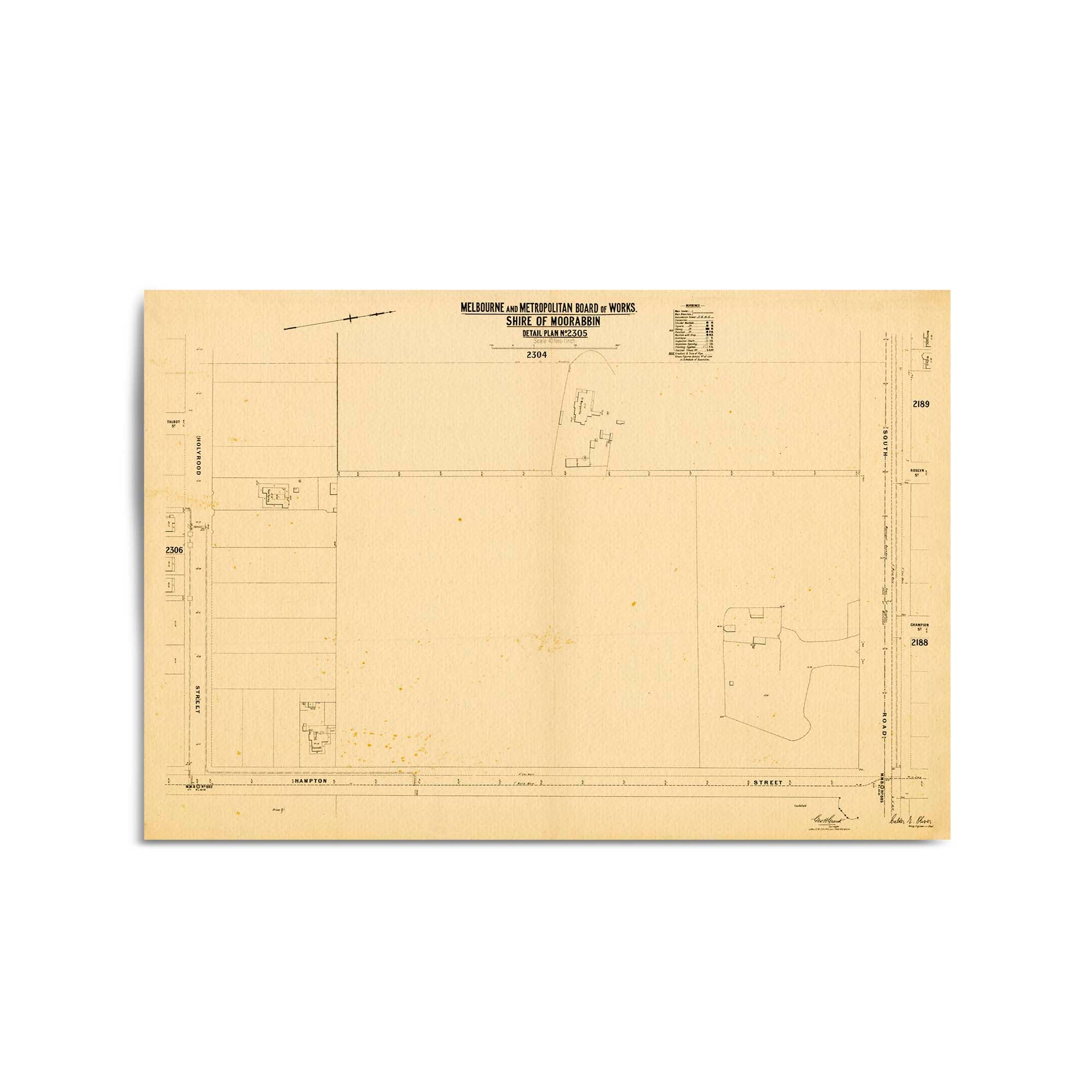
Late 1800's Vintage Map of Surrey Hills, Victoria Australia
From
$45.00
Surrey Hills, Victoria Australia Vintage Map #103 (188-)
From
$45.00
Parkville, Victoria Australia Vintage Map #13b (1883?)
From
$45.00
Parkville, Victoria Australia Vintage Map #13a (1883?)
From
$45.00
Parkville, Victoria Australia Vintage Map #5 (1897)
From
$45.00
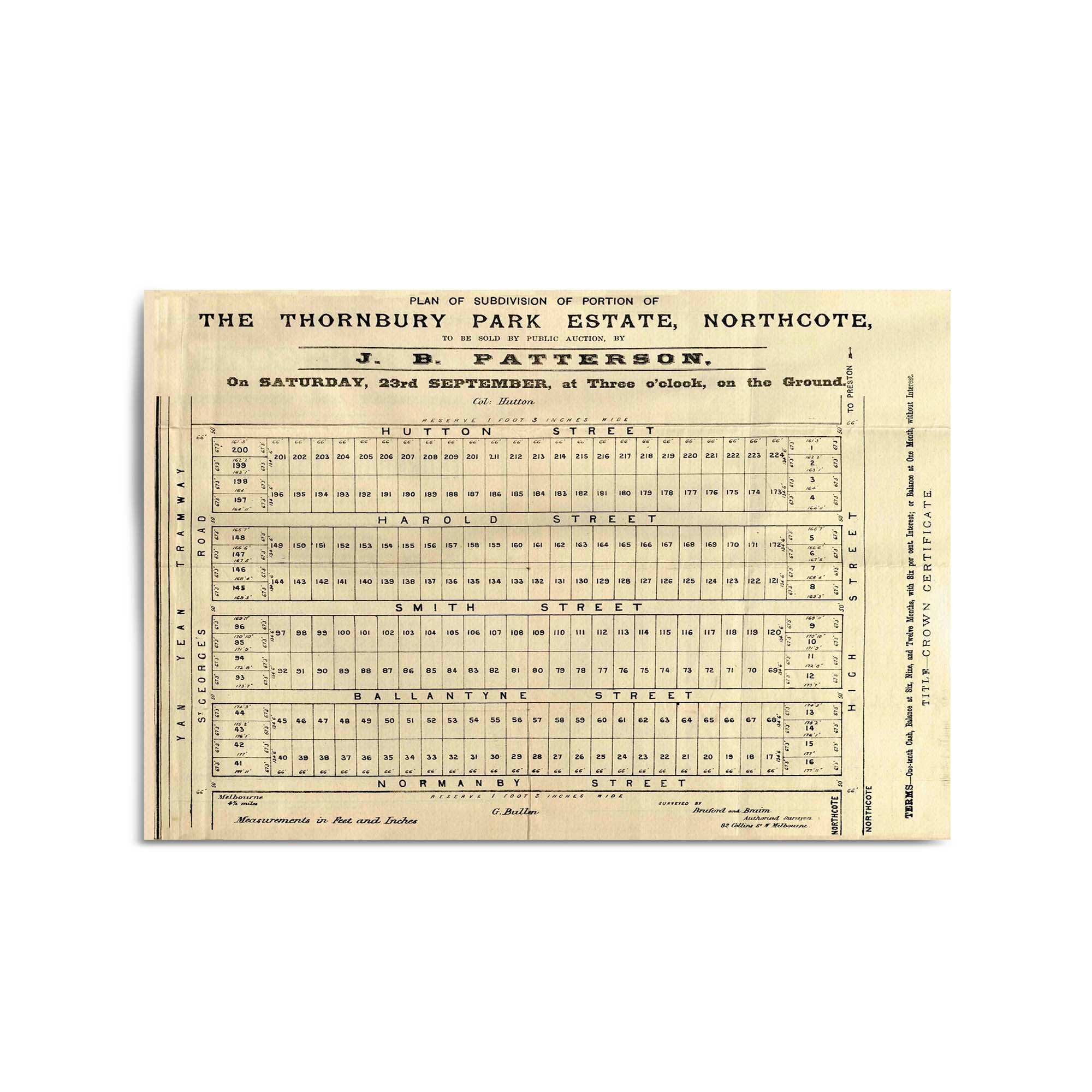
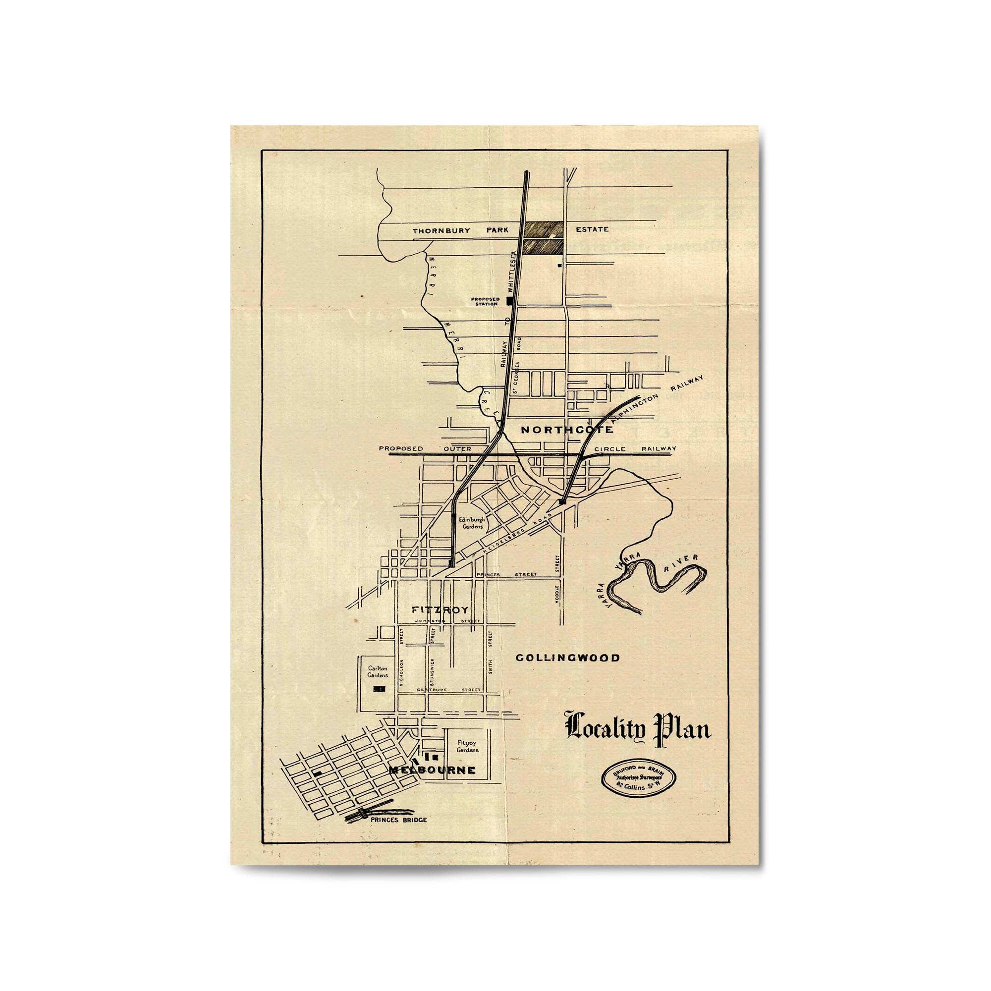
1882 Vintage Map of Northcote, Victoria Australia
From
$45.00
1882 Vintage Map of Northcote, Victoria Australia
From
$45.00
Northcote, Victoria Australia Vintage Map #45 (189-?)
From
$45.00
Mount Martha, Victoria Australia Vintage Map #19 (1953)
From
$45.00
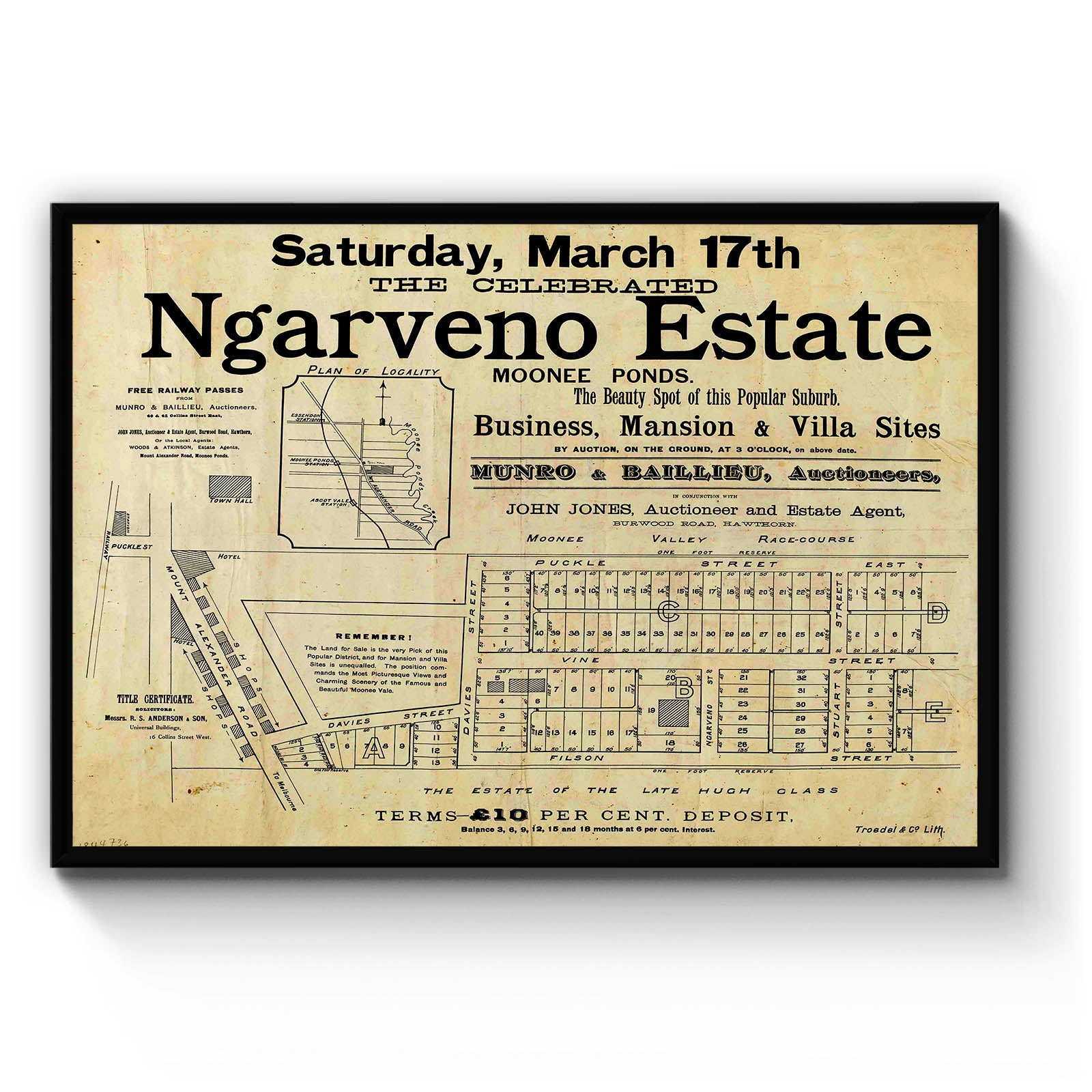
Moonee Ponds, Victoria Australia Vintage Map #9 (1881)
From
$45.00
Moonee Ponds, Victoria Australia Vintage Map #4 (1888)
From
$45.00
1889 Vintage Map of Moonee Ponds, Victoria Australia
From
$45.00
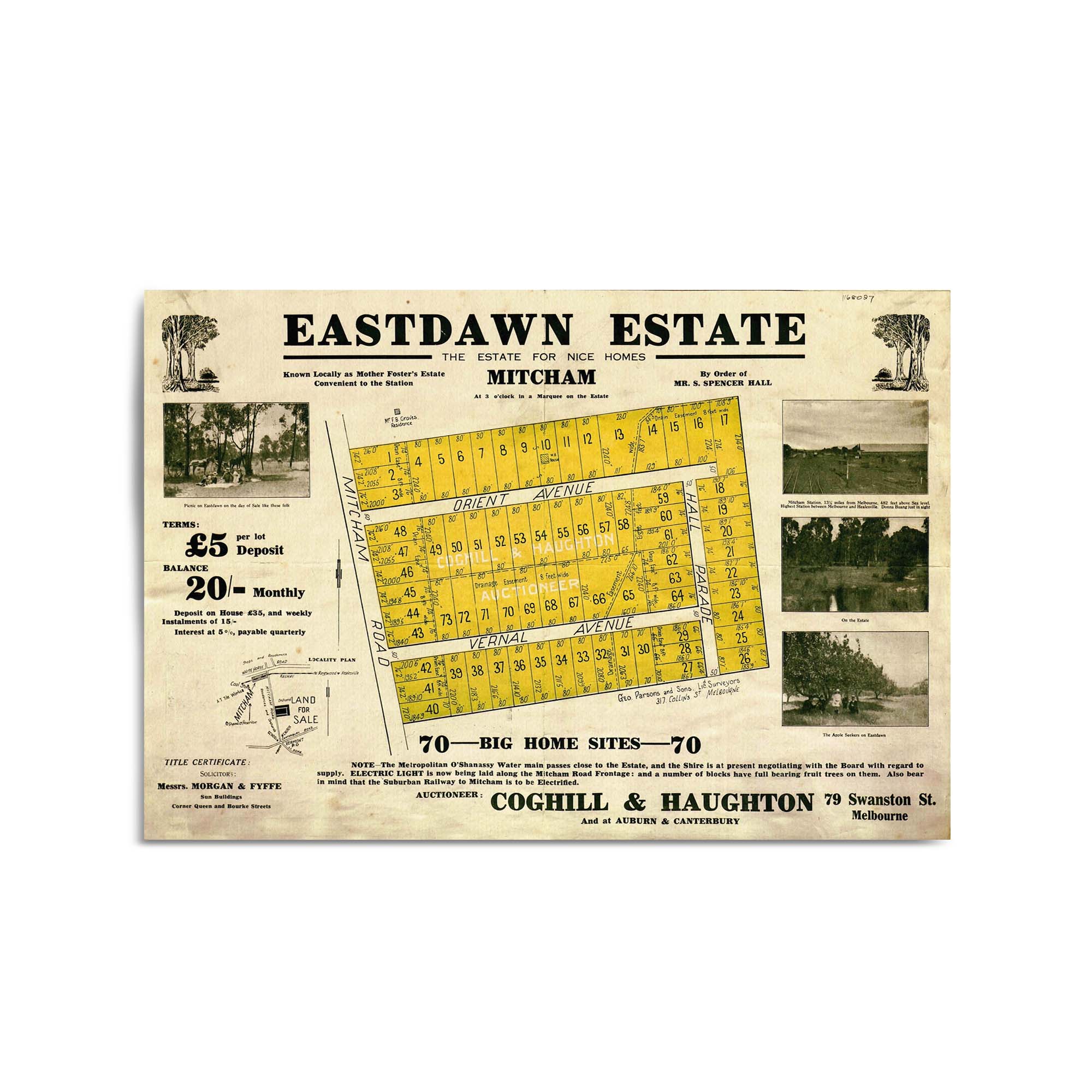
1880's Vintage Map of Mitcham, Victoria Australia
From
$45.00
Mitcham, Victoria Australia Vintage Map #15 (1887)
From
$45.00
1888 Vintage Map of Mitcham, Victoria Australia
From
$45.00
Shepparton, Victoria Australia Vintage Map #12 (1951)
From
$45.00
Shepparton, Victoria Australia Vintage Map #7a (1959)
From
$45.00
Sale, Victoria Australia Vintage Map #14c (1949)
From
$45.00
1956 Vintage Map of Ringwood, Victoria Australia
From
$45.00
1957 Vintage Map of Ringwood, Victoria Australia
From
$45.00
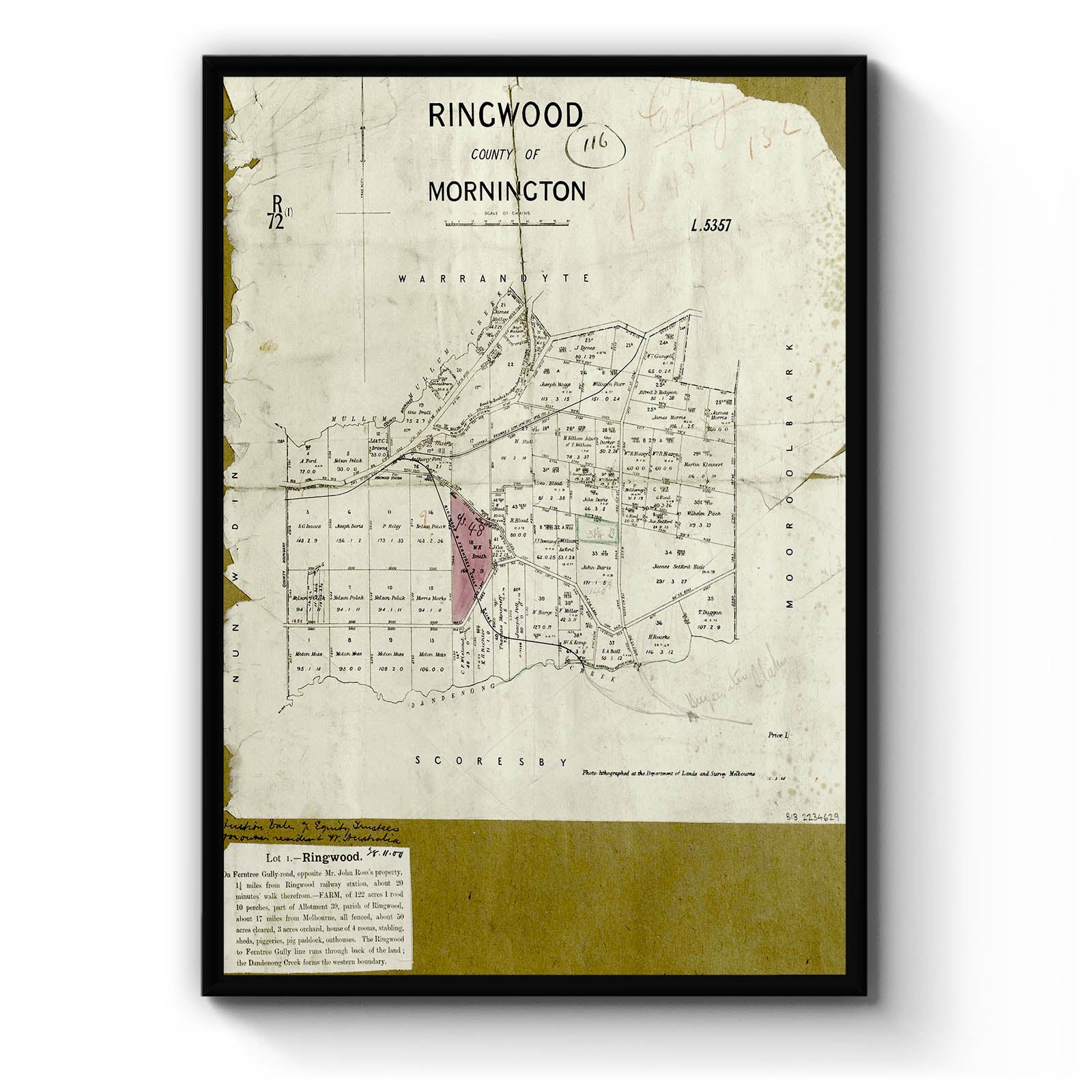
Ringwood, Victoria Australia Vintage Map #9 (1879)
From
$45.00
Ringwood, Victoria Australia Vintage Map #7 (1885)
From
$45.00
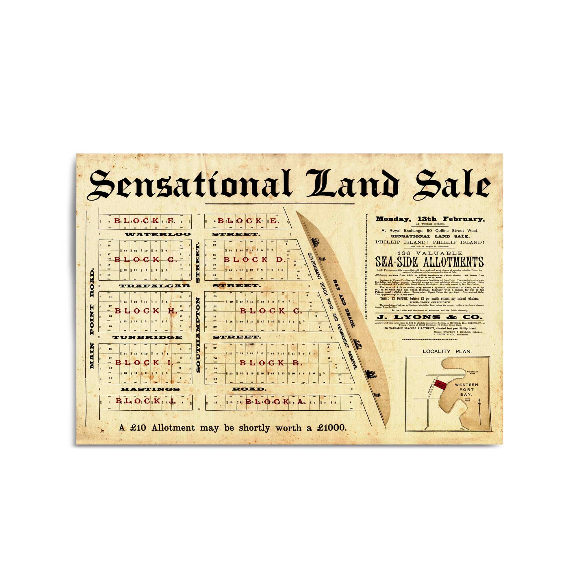
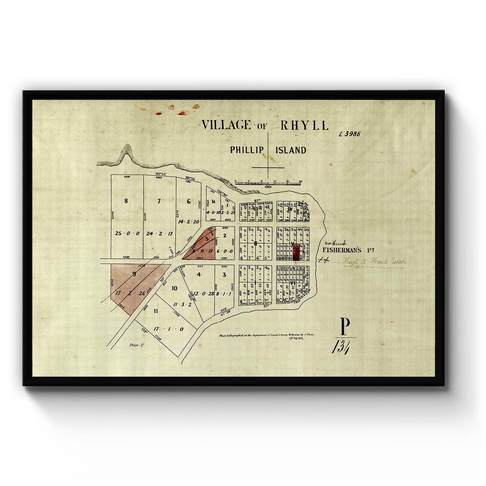
Phillip Island, Victoria Australia Vintage Map #23 (193-?)
From
$45.00
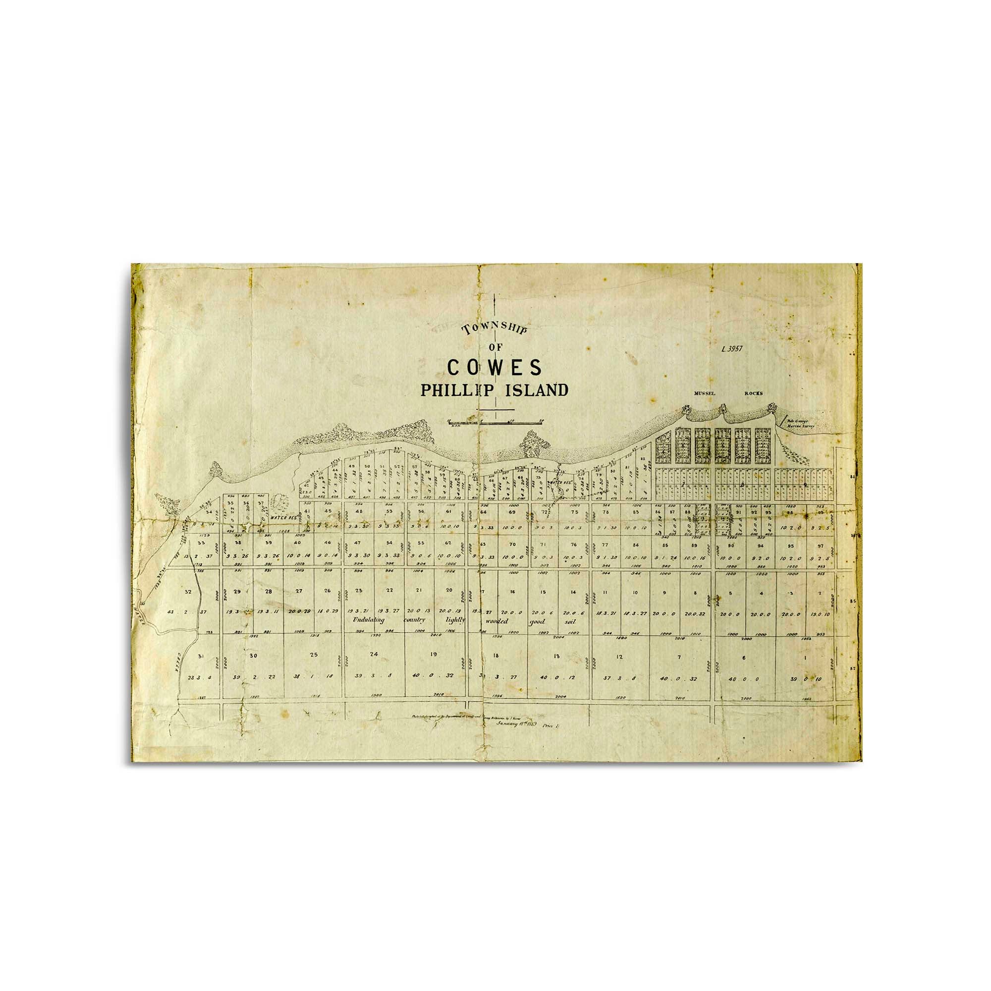
1867 Vintage Map of Phillip Island, Victoria Australia
From
$45.00
Phillip Island, Victoria Australia Vintage Map #7 (1868)
From
$45.00
1882 Vintage Map of Phillip Island, Victoria Australia
From
$45.00
Phillip Island, Victoria Australia Vintage Map #4 (1888?)
From
$45.00
Phillip Island, Victoria Australia Vintage Map #3 (1889)
From
$45.00
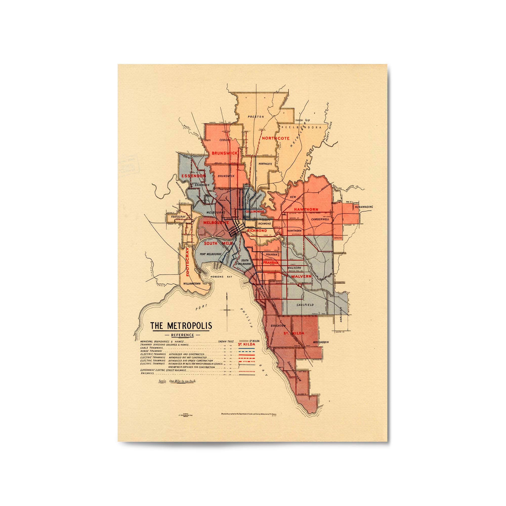
1917 Map of Melbourne and Inner Suburbs
From
$45.00
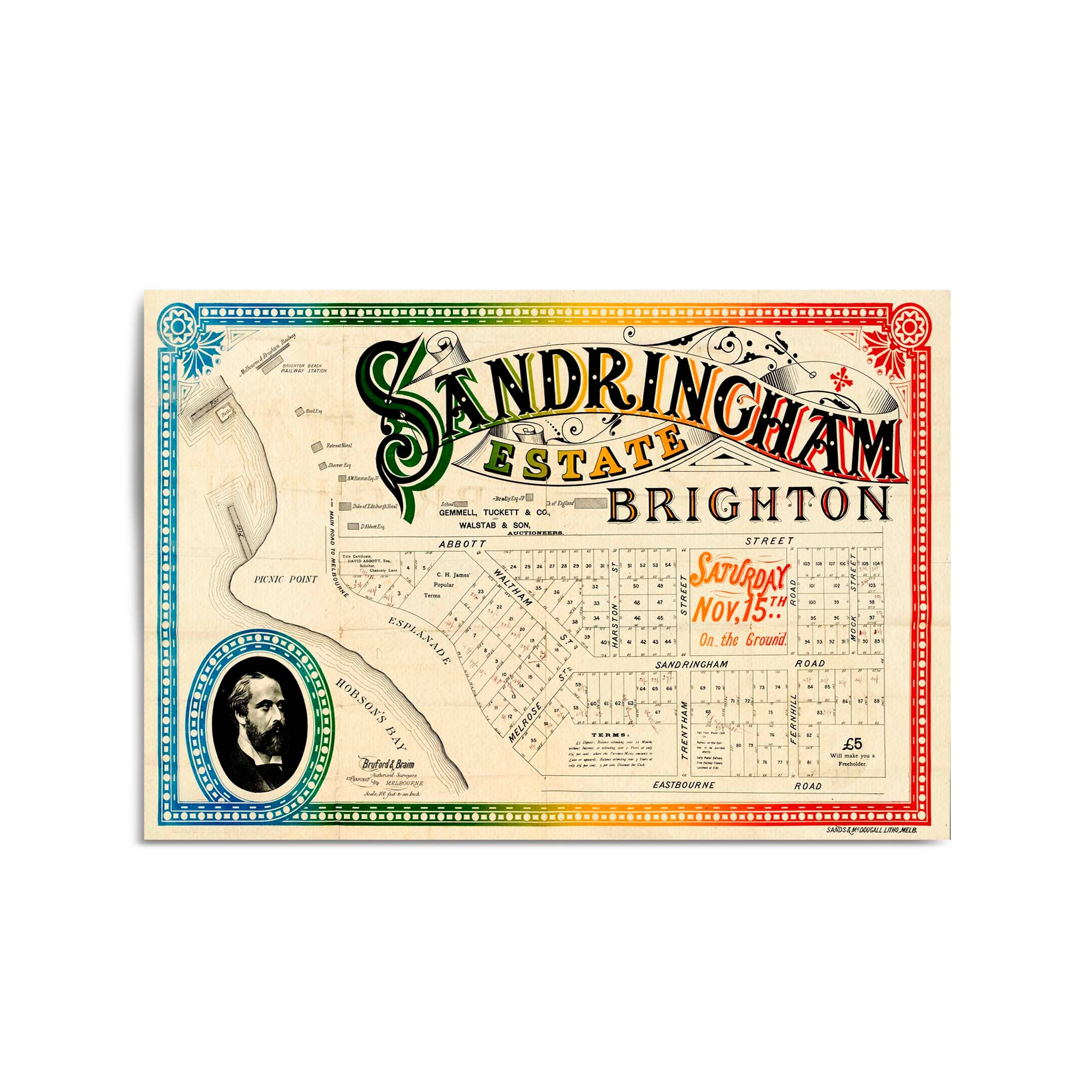
Sandringham, Victoria Australia Vintage Map #2 (1884)
From
$45.00
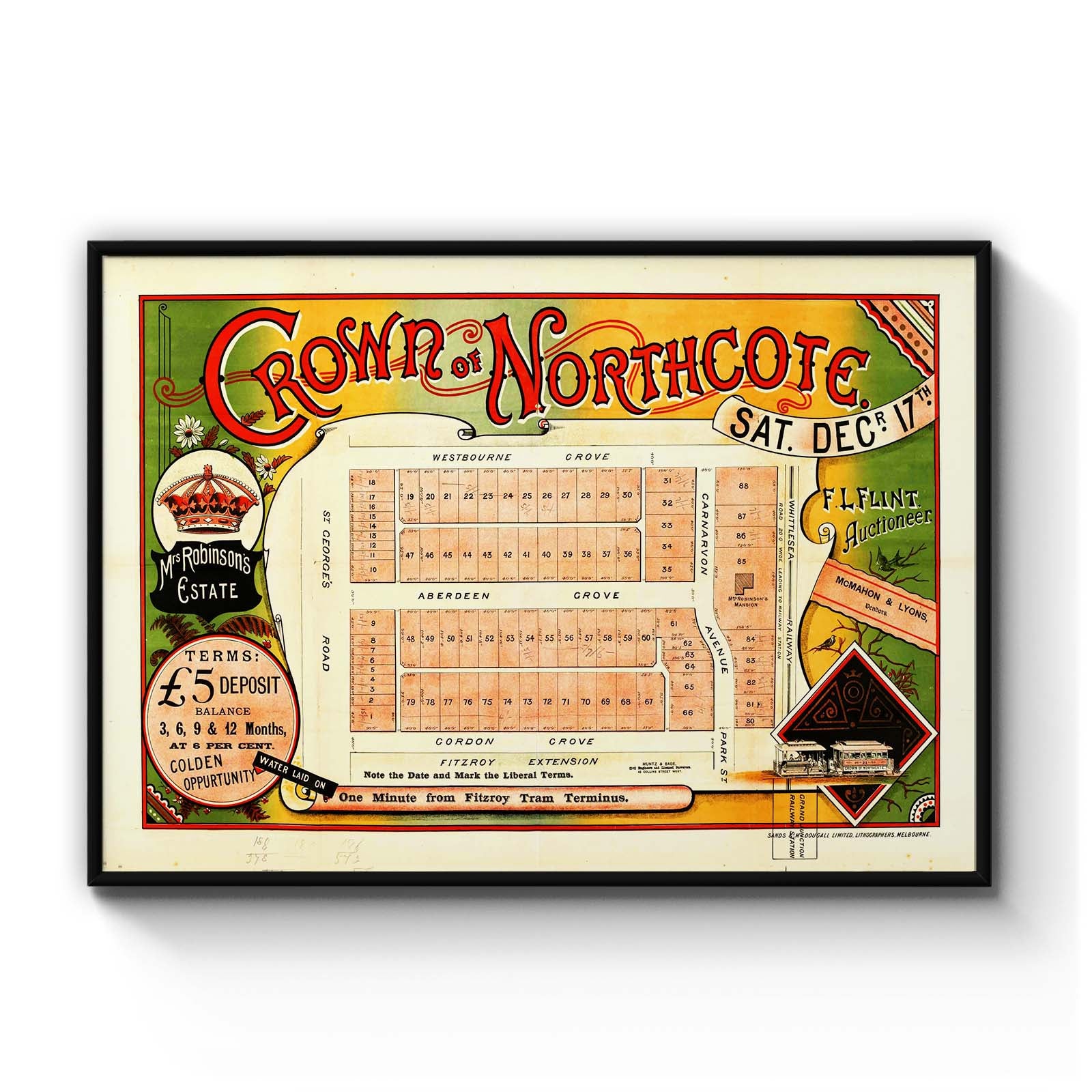
Northcote, Victoria Australia Vintage Map #20 (1887?)
From
$45.00
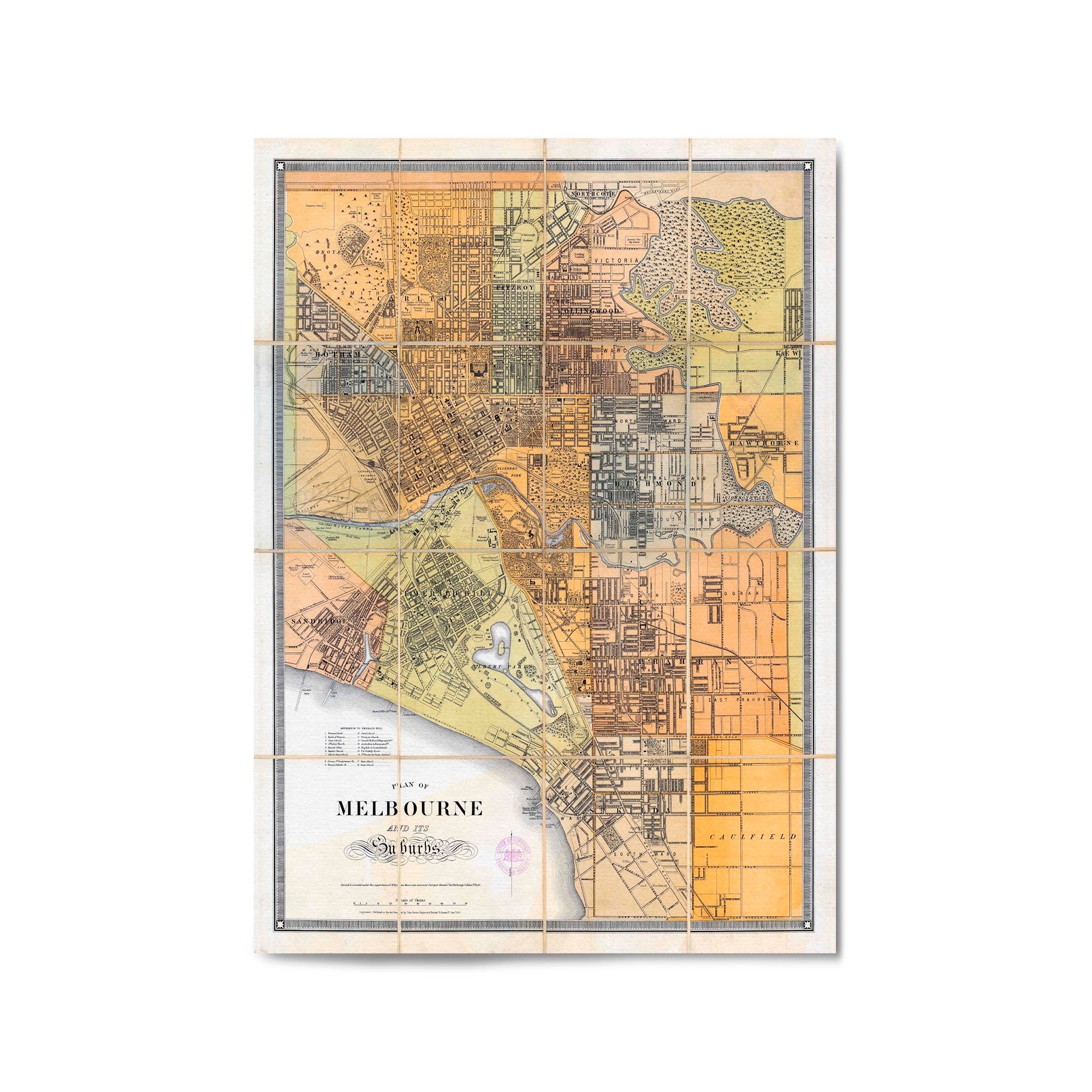
1879 Map of Melbourne and Suburbs, Victoria Australia
From
$45.00
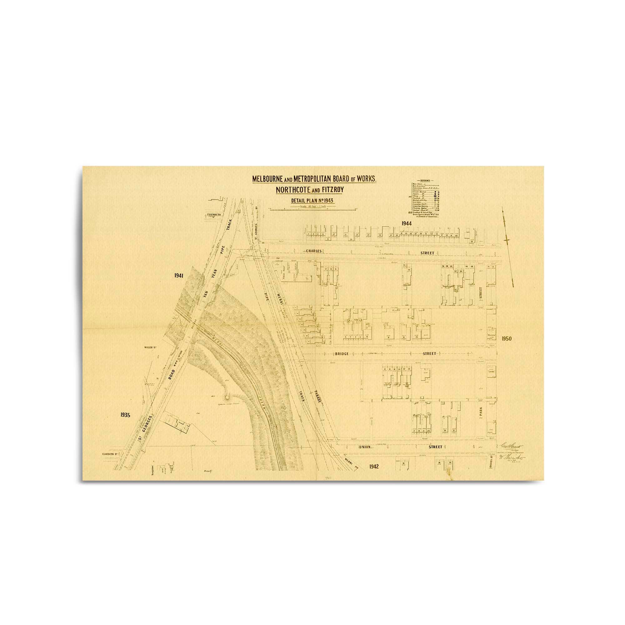
1889 Vintage Map of Fitzroy, Victoria Australia
From
$45.00
1884 Vintage Map of Brunswick, Victoria Australia
From
$45.00
1966 Map of Central Western Australia
From
$45.00
z1930 Vintage Map of Preston, Victoria Australia
From
$45.00
1903 Vintage Map of Hawthorn, Victoria, Australia
From
$45.00
1914 Vintage Map of East Malvern, Victoria Australia
From
$45.00
1908 Vintage Map of Brighton, Victoria Australia
From
$45.00
1906 Vintage Map of Northcote, Victoria Australia
From
$45.00
1955 Map of Northern Territory
From
$45.00
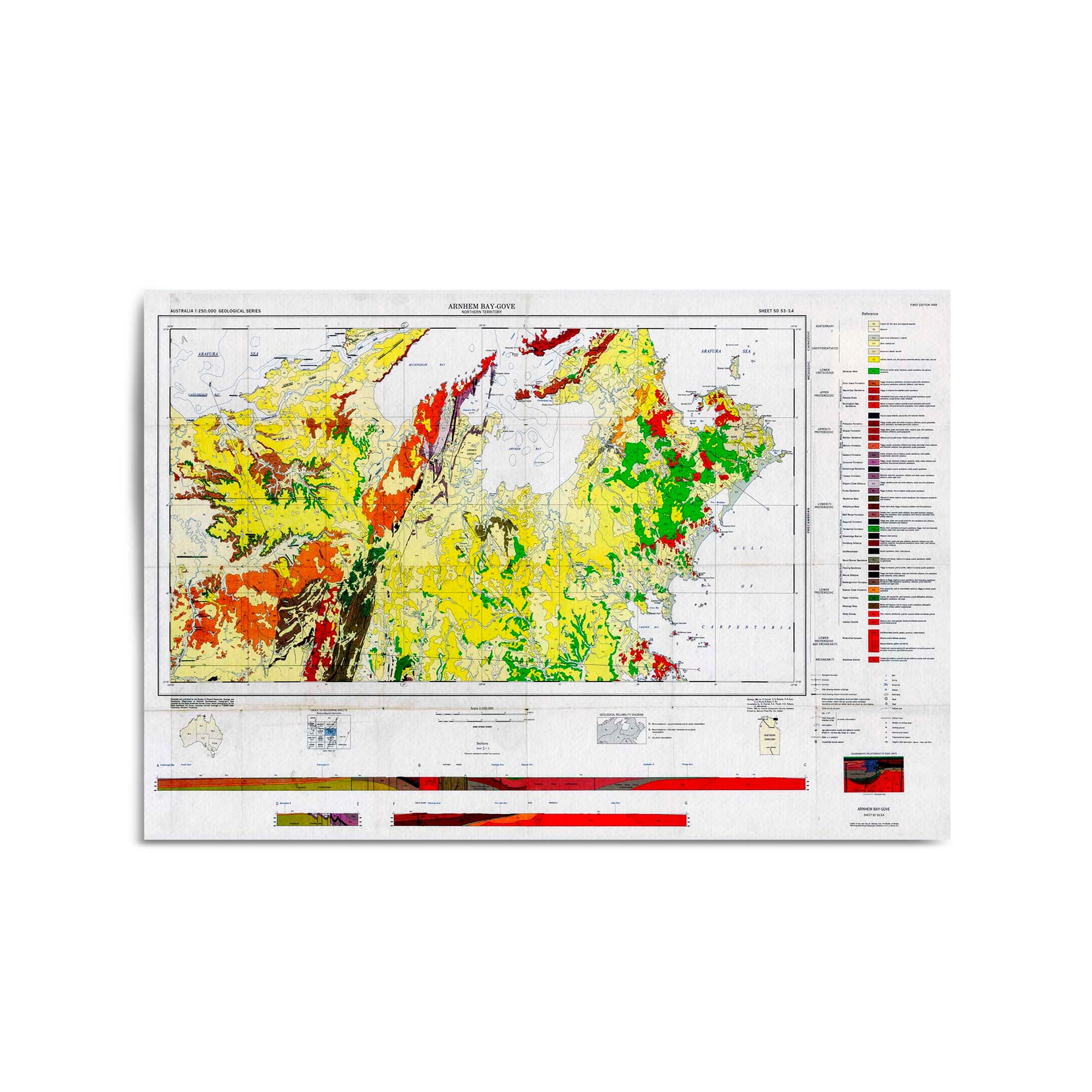
1968 Map of East Arnhem, Northern Territory
From
$45.00
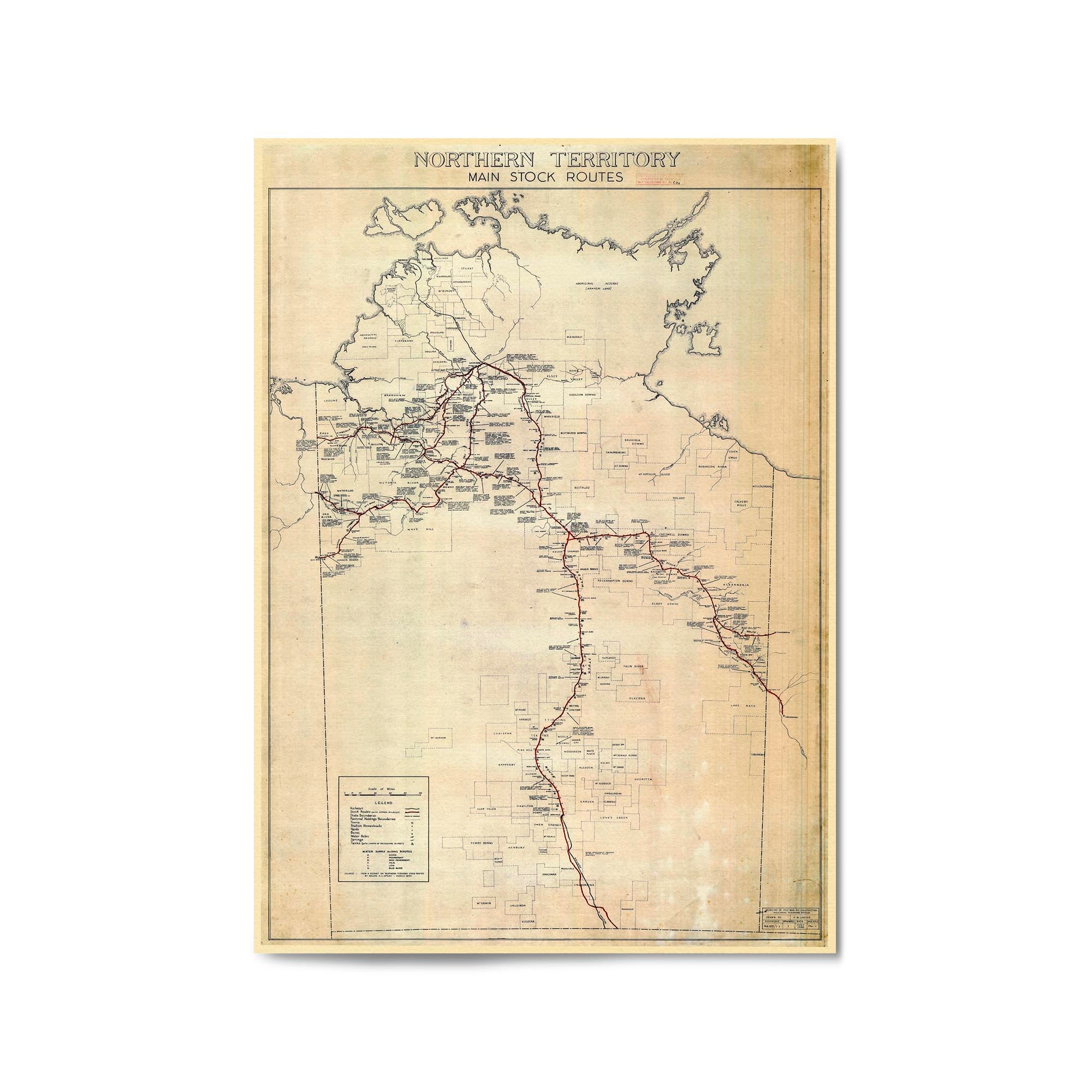
1946 Map of the Northern Territory Showing Main Stock Routes
From
$45.00
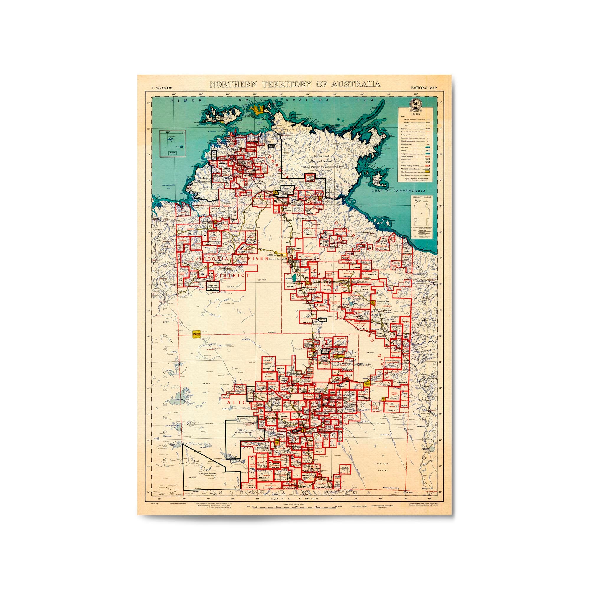
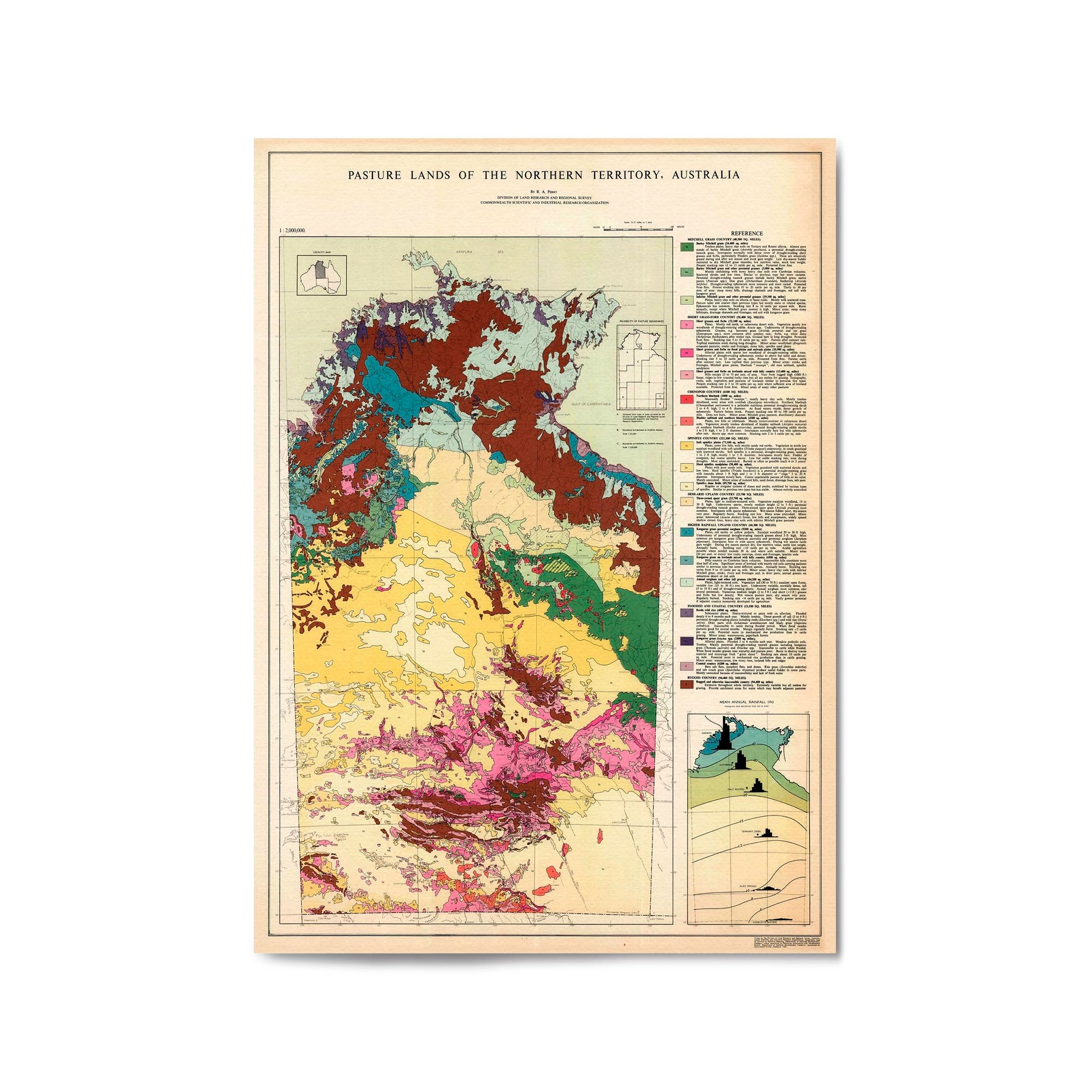
1960 Pasture Lands Map of the Northern Territory
From
$45.00
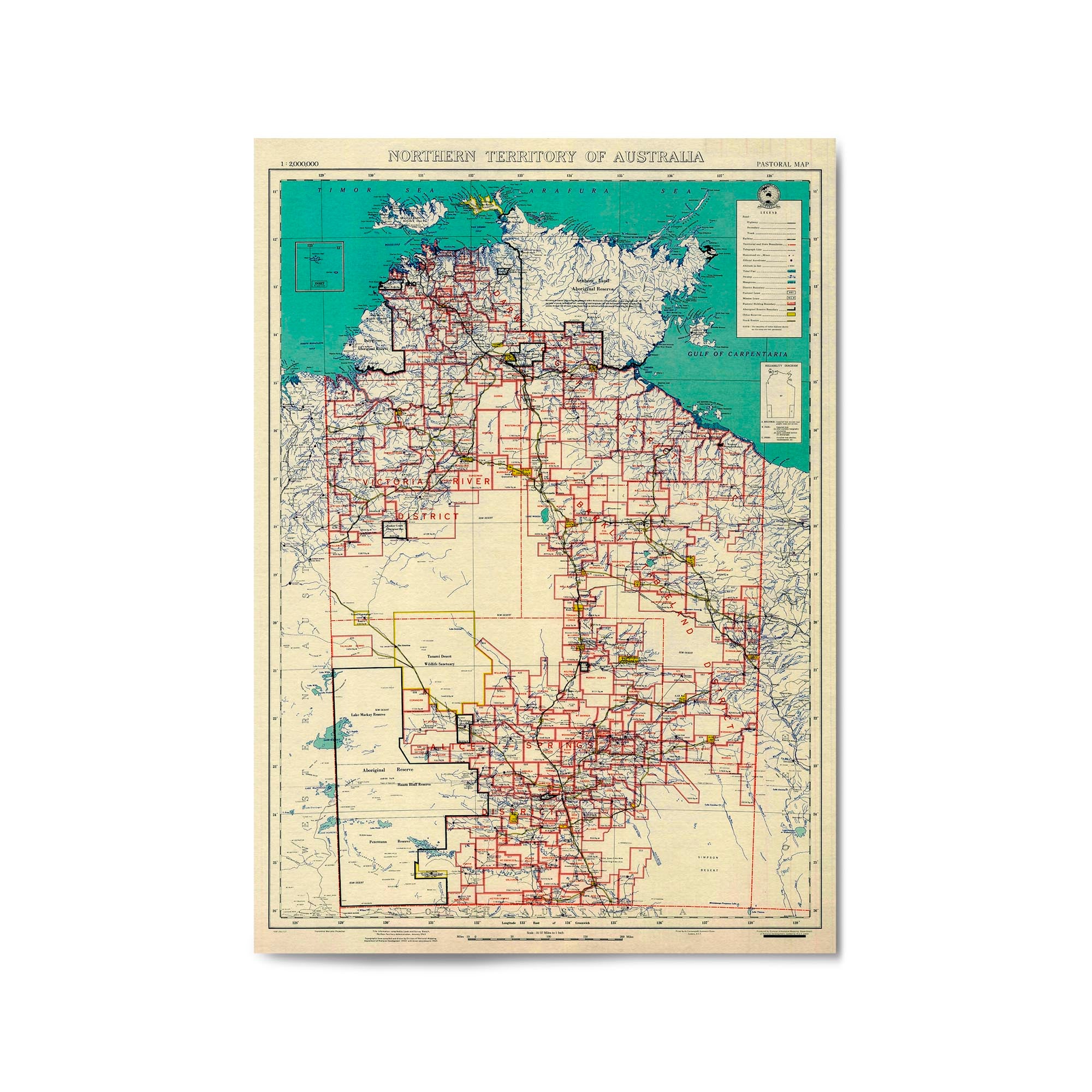
1969 Map of the Northern Territory
From
$45.00
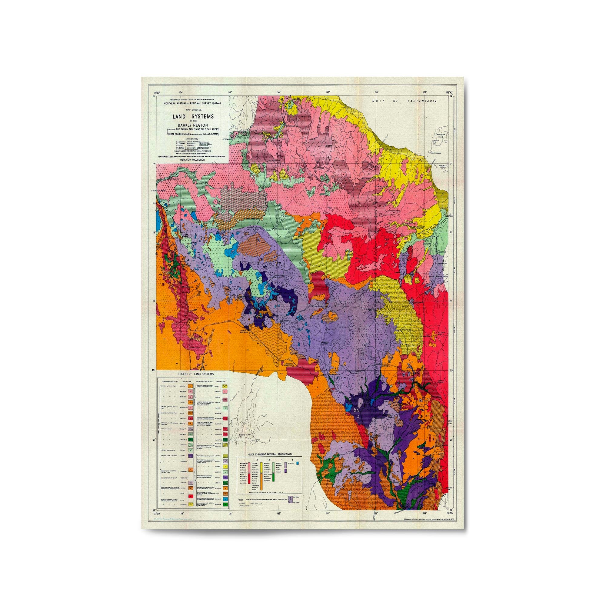
1950 Map of Barkly Region, Northern Territory
From
$45.00
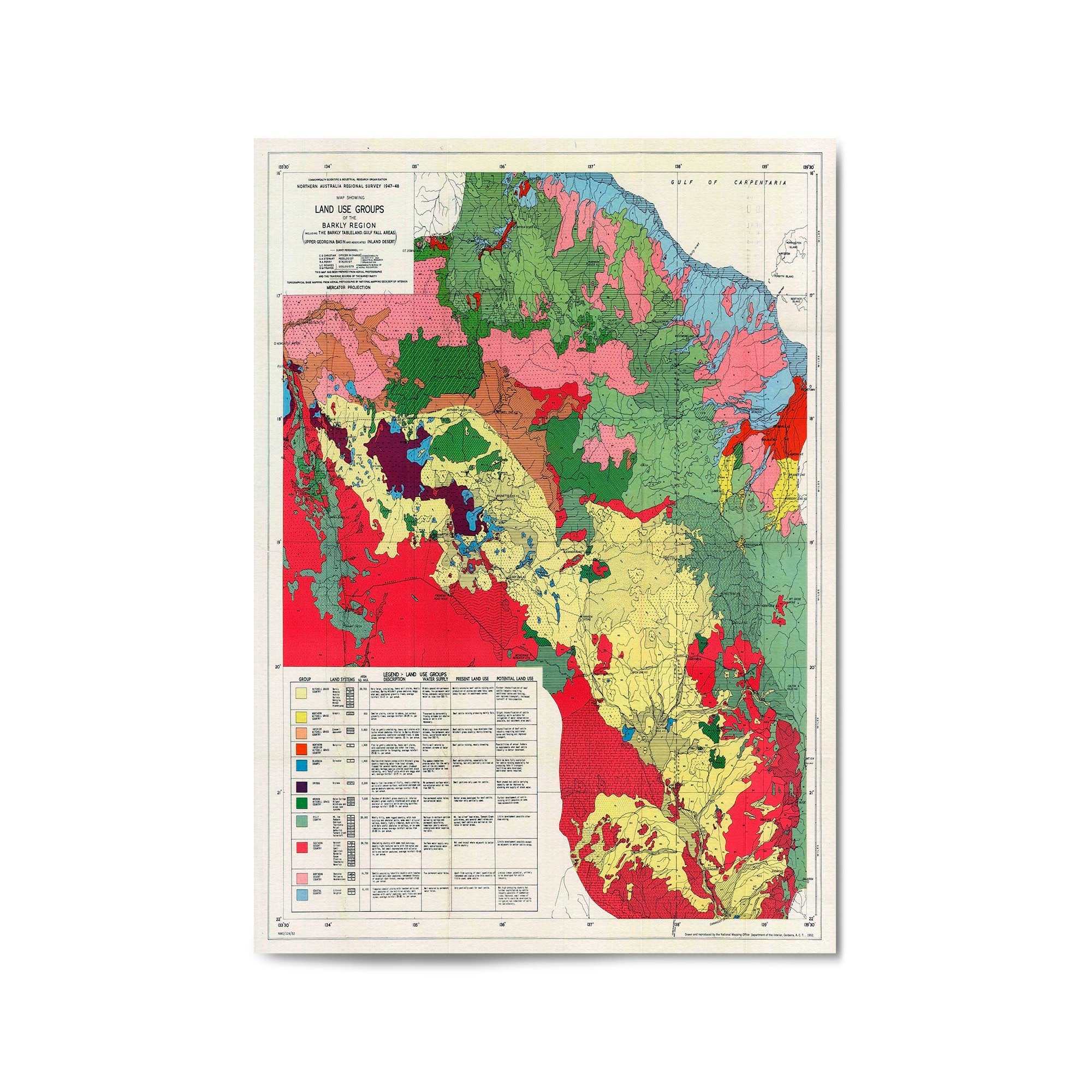
1952 Map of Barkly Region, Northern Territory
From
$45.00
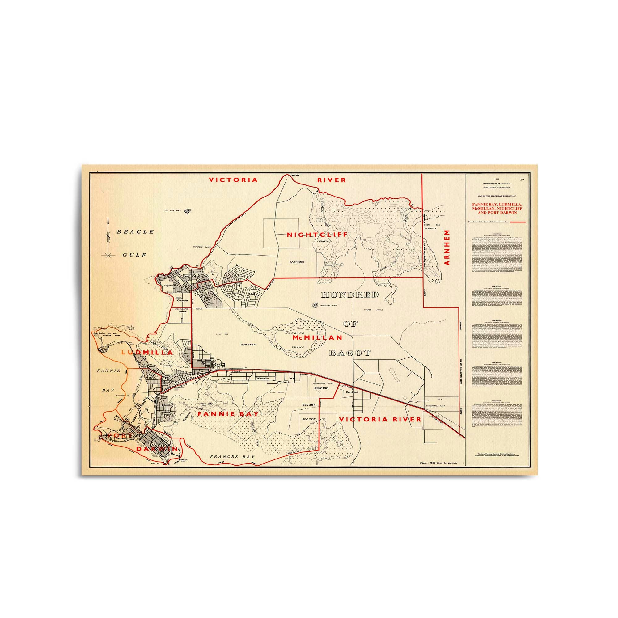
1968 Map of Darwin & Surrounds, Northern Territory
From
$45.00
« Previous
·
1
…
24
25
26
27
28
…
135
·
Next »