Skip to content
Facebook
Instagram
Delivery by Christmas: Unframed Orders, Monday 15 December for all states except TAS, NT & WA; Friday 12 December for TAS, NT & WA.Framed Orders, Wednesday 10 December for all states except TAS, NT & WA; Friday 5 December for TAS, NT & WA.
Search
World Maps
Australia Maps
ACT Maps
NSW Maps
NT Maps
QLD Maps
SA Maps
TAS Maps
VIC Maps
WA Maps
Gift Vouchers
Account
Search
Cart
Search By Street Name or Suburb e.g. 'Punt Road' or Toorak
World Maps
Australia Maps
ACT Maps
NSW Maps
NT Maps
QLD Maps
SA Maps
TAS Maps
VIC Maps
WA Maps
Gift Vouchers
🚚 Free Shipping
Australia-wide.
↩️ No Fuss
14-Days Free Returns.
Excellent ⭐⭐⭐⭐⭐
2,500 Happy Customers.
Free Shipping Australia-Wide — No-Fuss 14 Day Free Returns — Over 2,500 Happy Customers
Customers rate us 4.9/5 based on 18 reviews.
Products
6475 products
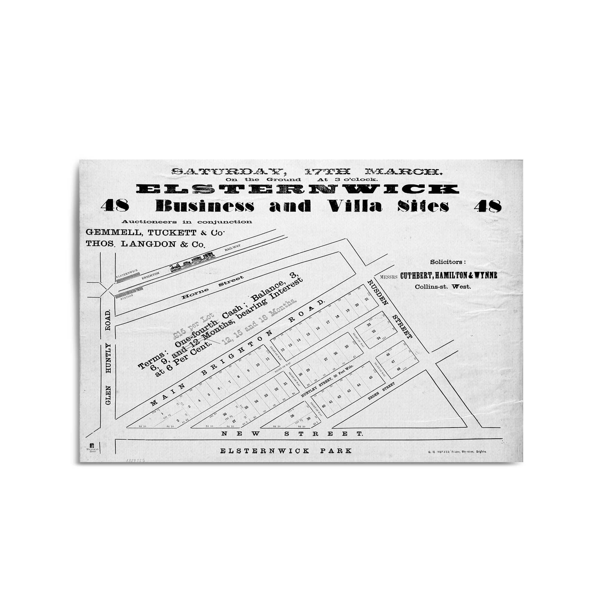
1800's Vintage Map of Elsternwick, Victoria Australia
From
$45.00
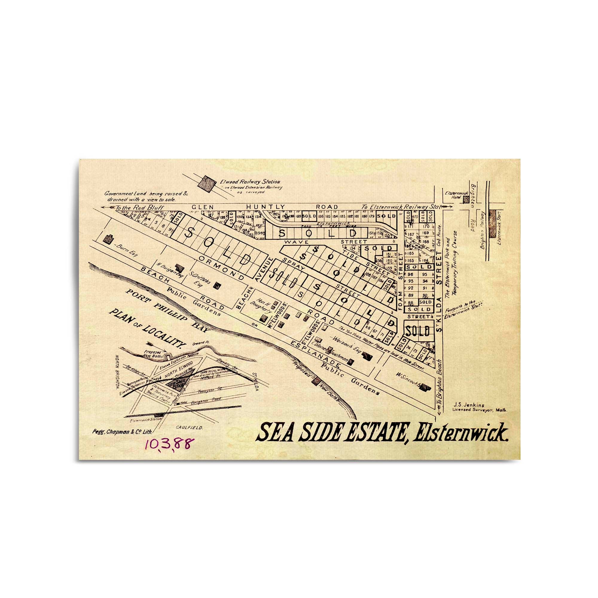
1800's Vintage Map of Elwood, Victoria Australia
From
$45.00
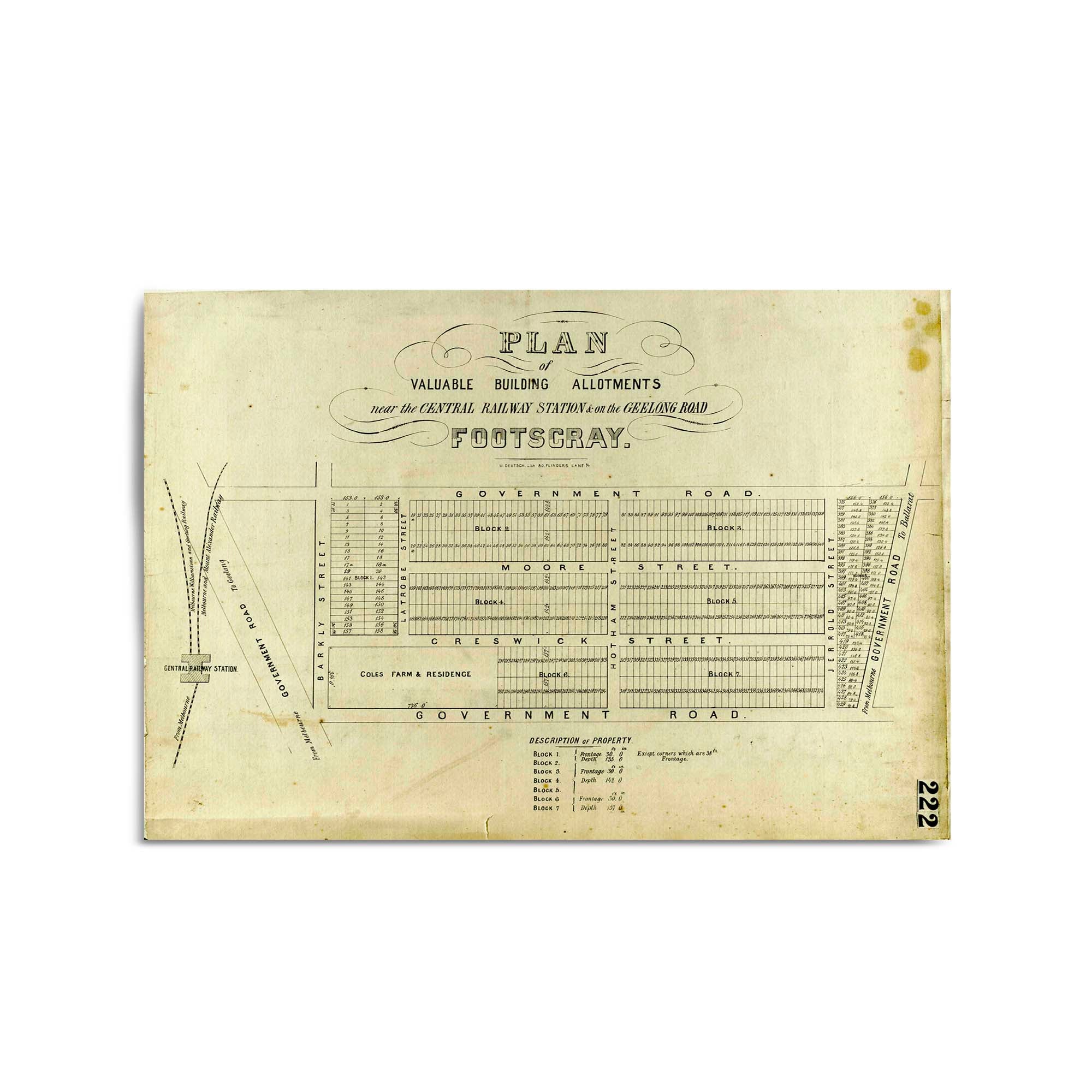
1800's Vintage Map of Footscray, Victoria Australia
From
$45.00
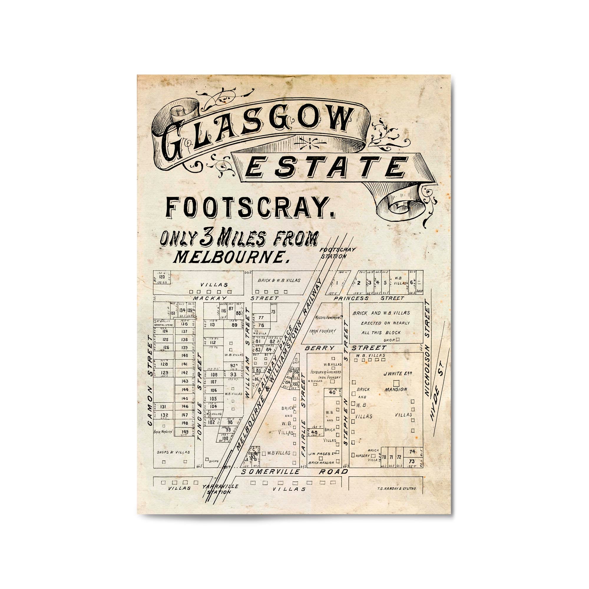
1800's Vintage Map of Footscray, Victoria Australia
From
$45.00
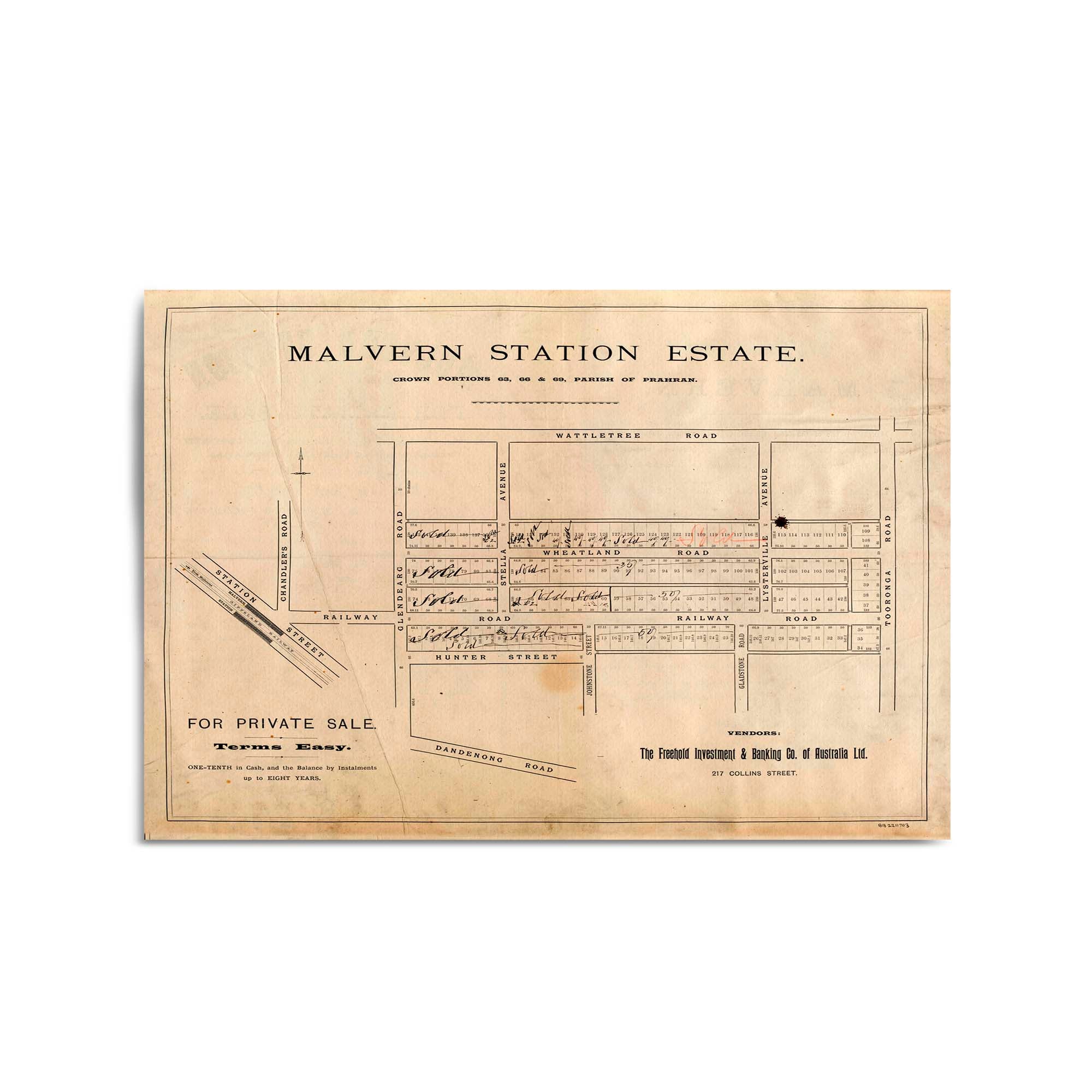
1800's Vintage Map of Malvern, Victoria Australia
From
$45.00
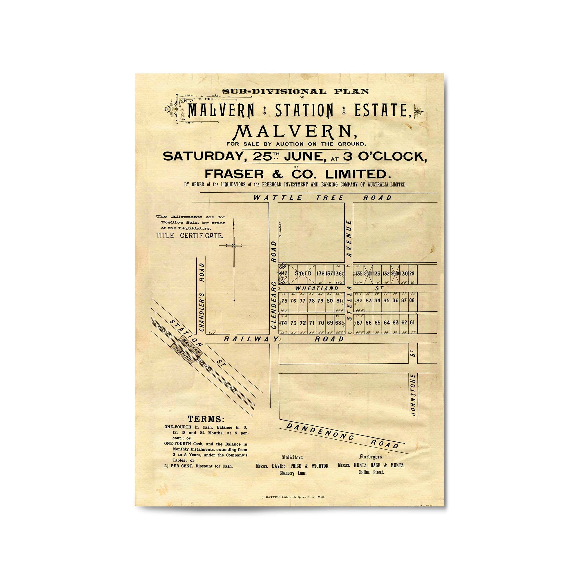
1800's Vintage Map of Malvern, Victoria Australia
From
$45.00
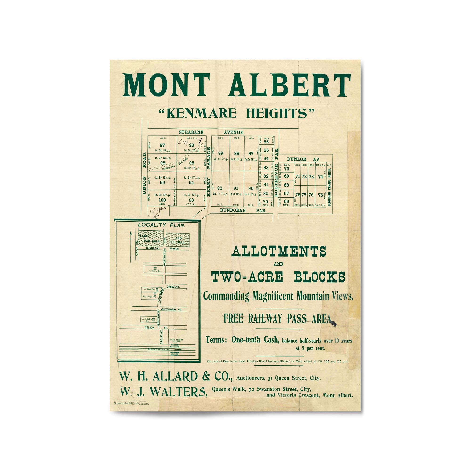
1800's Vintage Map of Mont Albert, Victoria Australia
From
$45.00
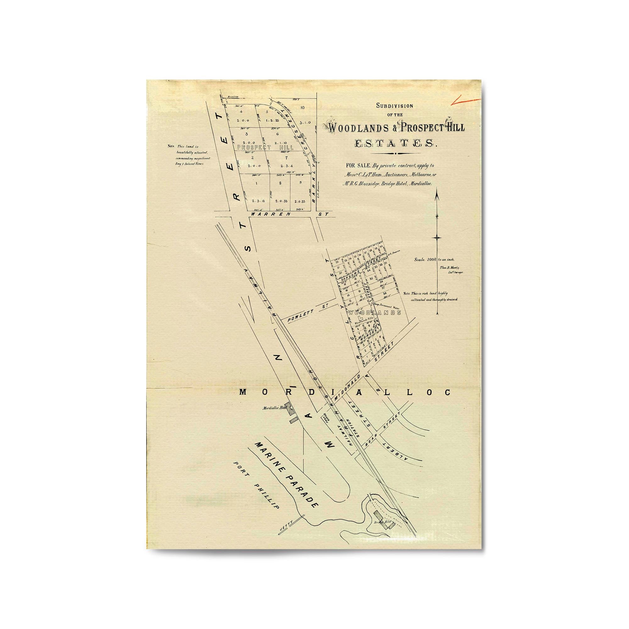
1800's Vintage Map of Mordialloc, Victoria Australia
From
$45.00
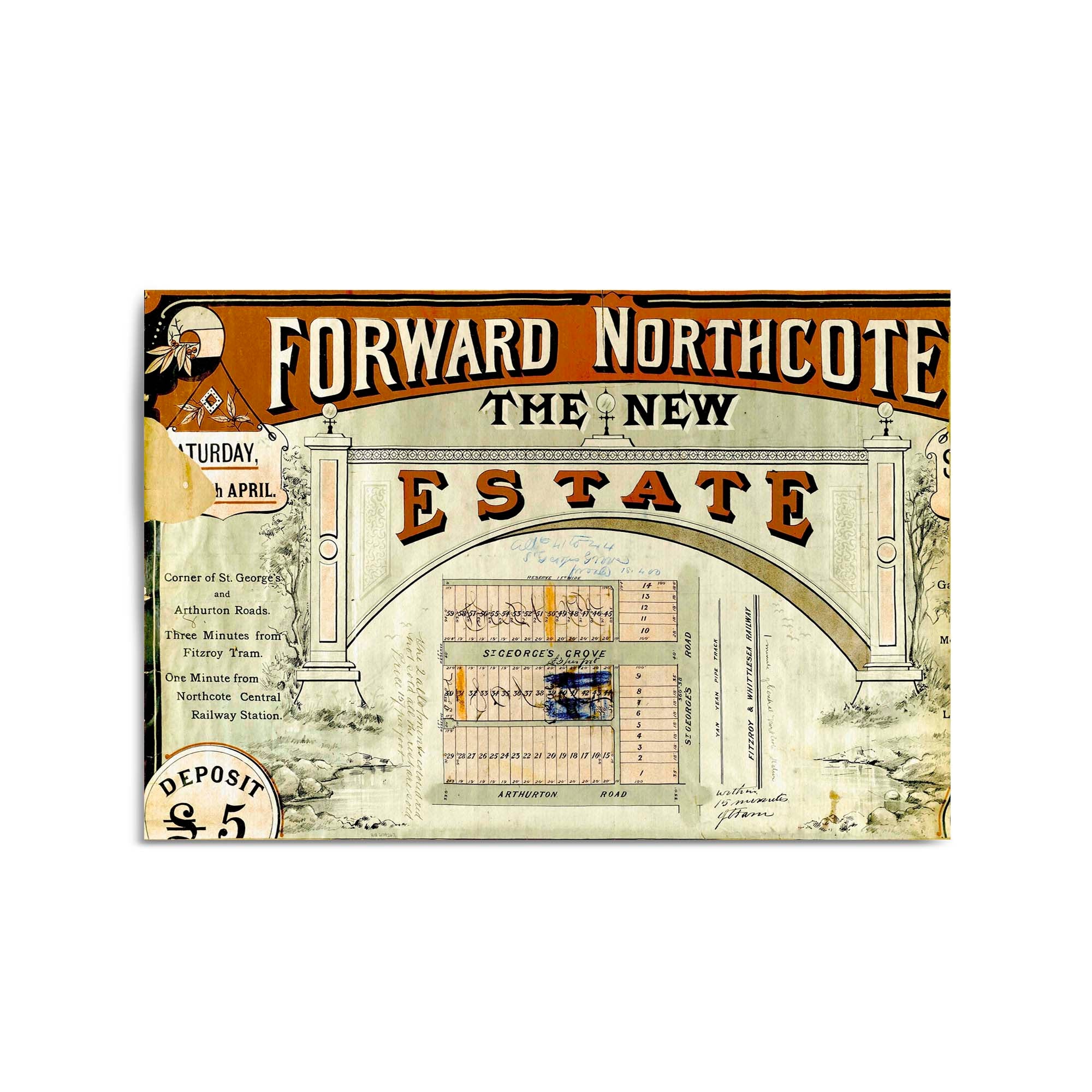
1800's Vintage Map of Northcote, Victoria Australia
From
$45.00
1800's Vintage Map of Prahran, Victoria Australia
From
$45.00
1800's Vintage Map of Ripponlea, Victoria Australia
From
$45.00
1800's Vintage Map of St Kilda, Victoria Australia
From
$45.00
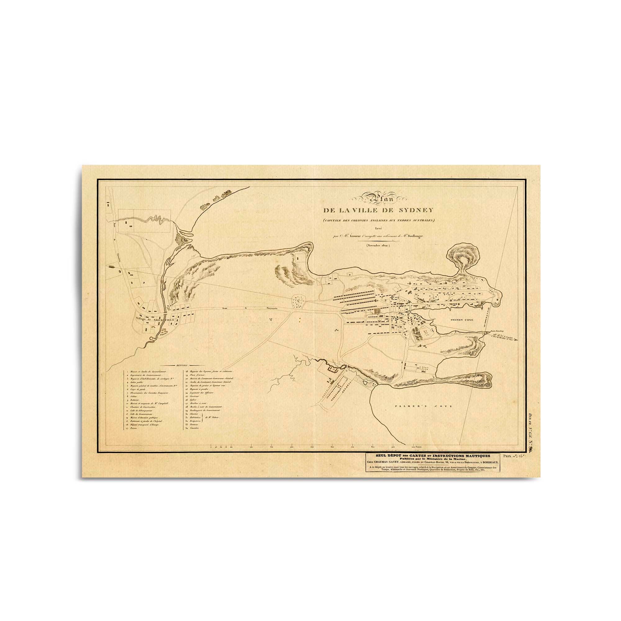
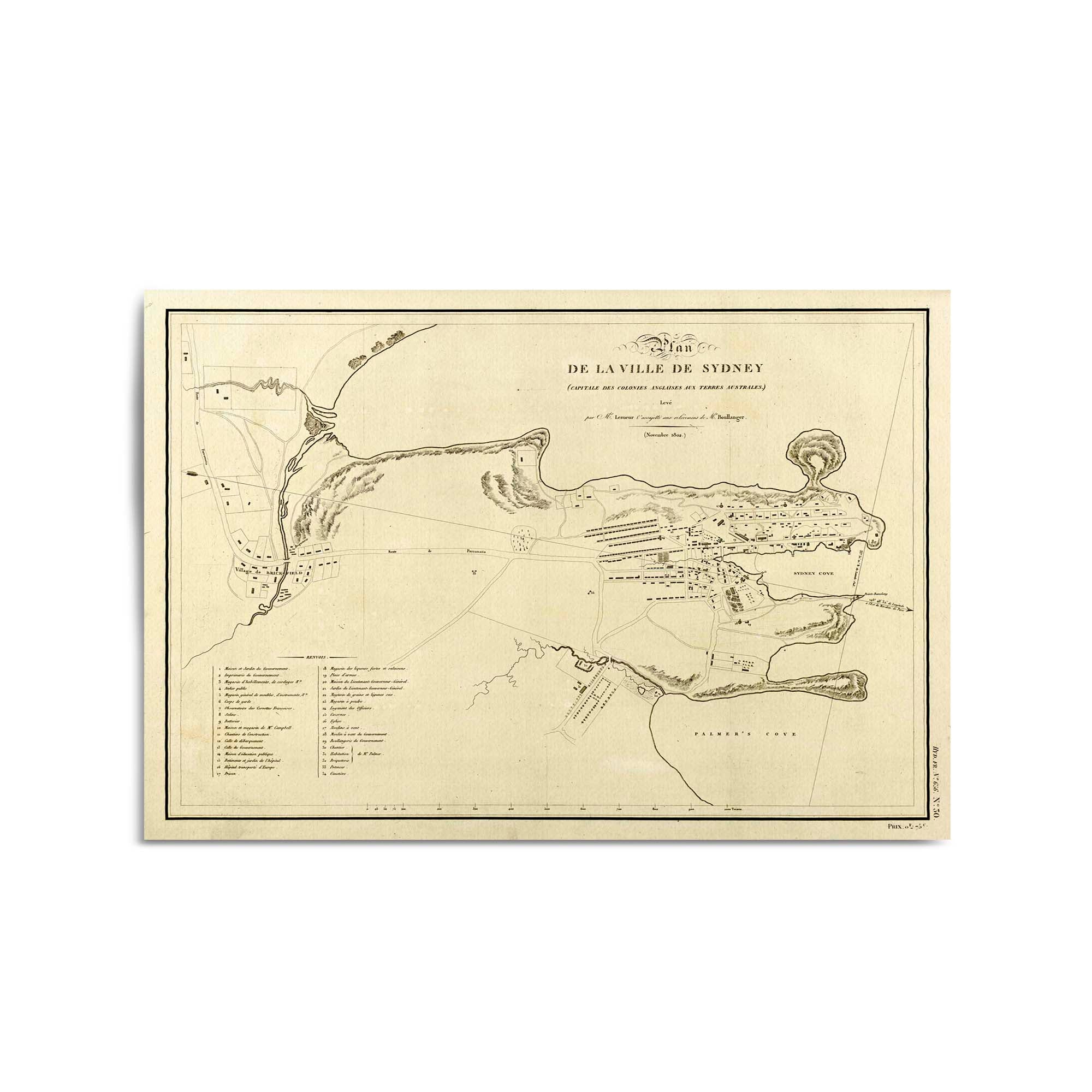
1801 Plan of the town of Sydney, New South Wales (French)
From
$45.00
1802 Chart of the three harbours of Botany Bay, Port Jackson and Broken Bay
From
$45.00
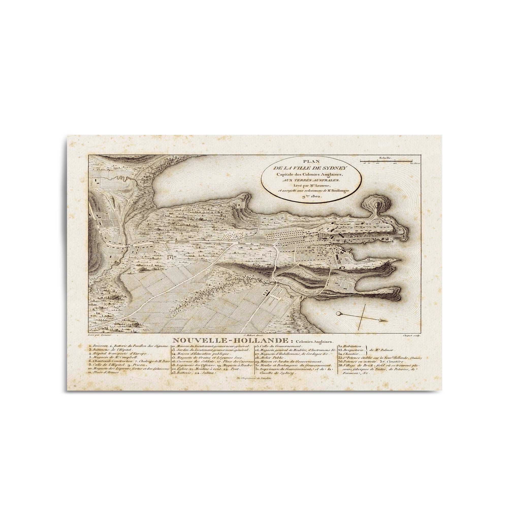
1802 Map of Sydney, New South Wales
From
$45.00
1802 Map of Sydney, New South Wales
From
$45.00
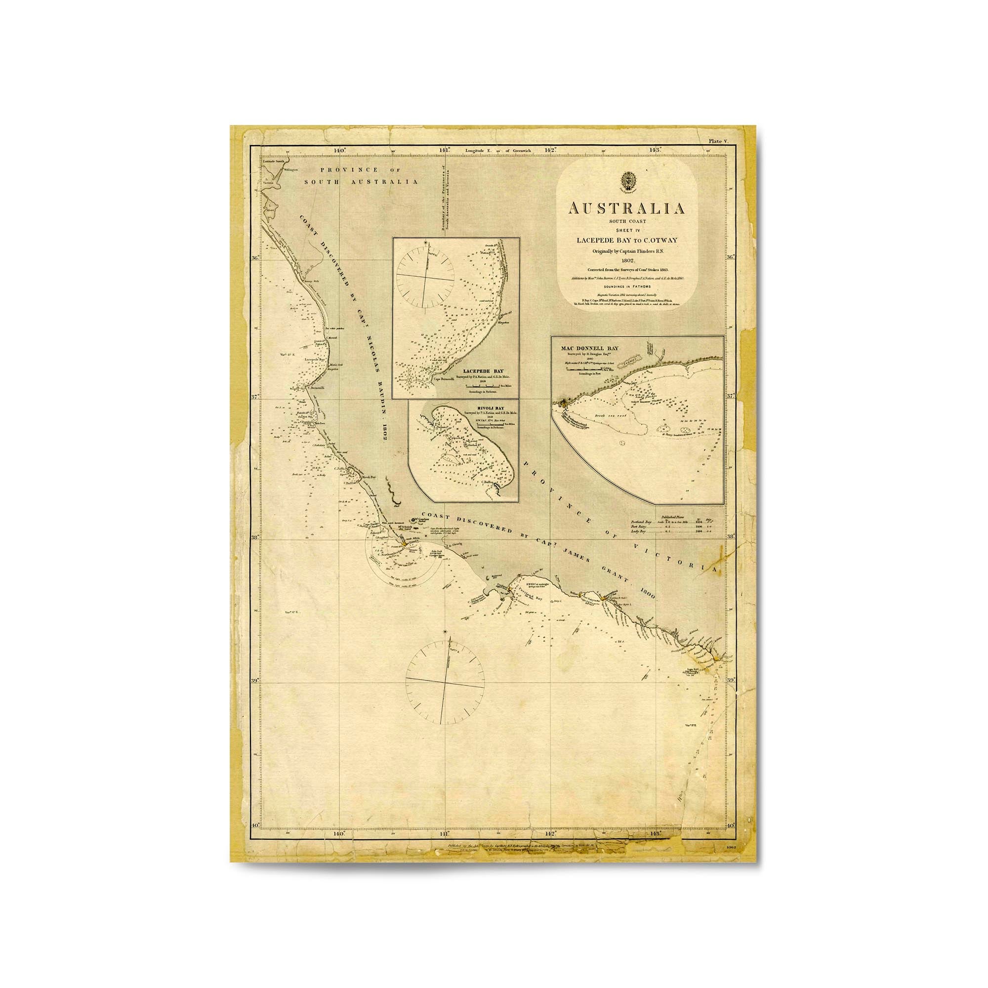
1802 Vintage Map of Australia - South Coast. Lacapede Bay to Cape Otway
From
$45.00
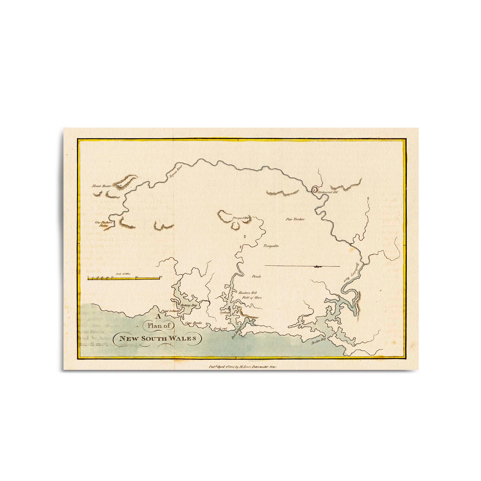
1803 Plan of New South Wales
From
$45.00
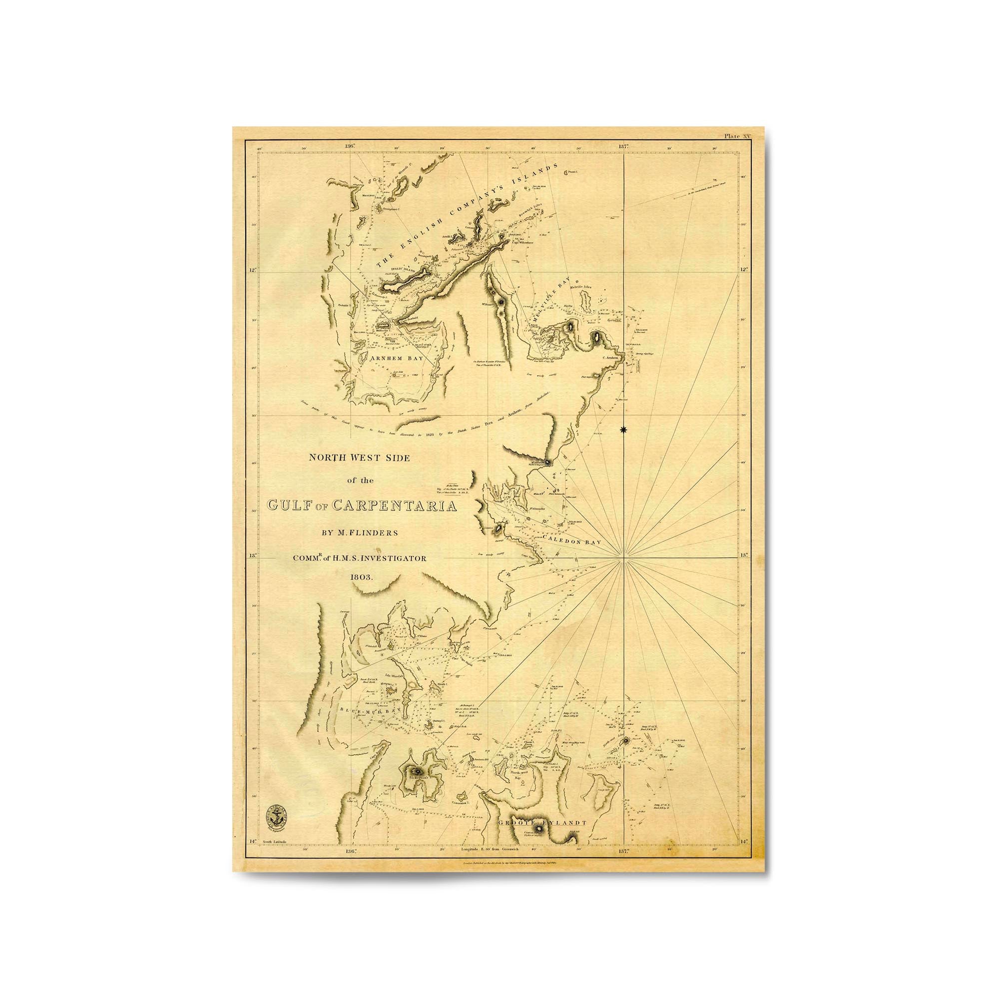
1803 Vintage Map of the Gulf of Carpentaria (North West Side)
From
$45.00
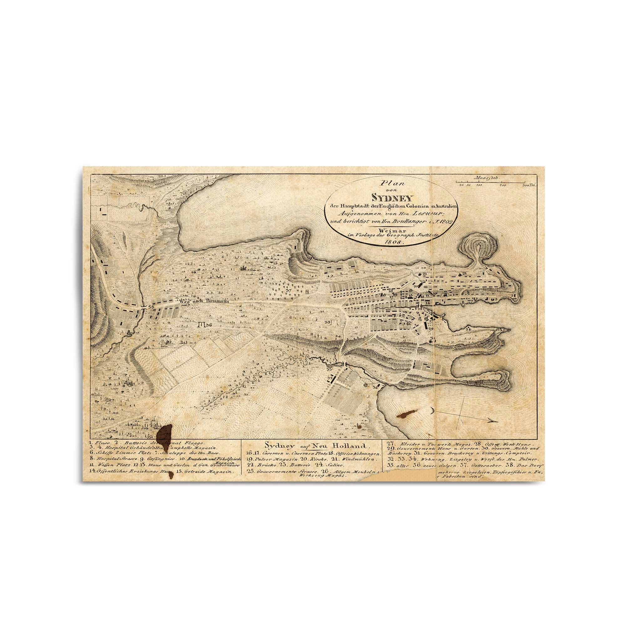
1808 Map of Sydney, New South Wales
From
$45.00
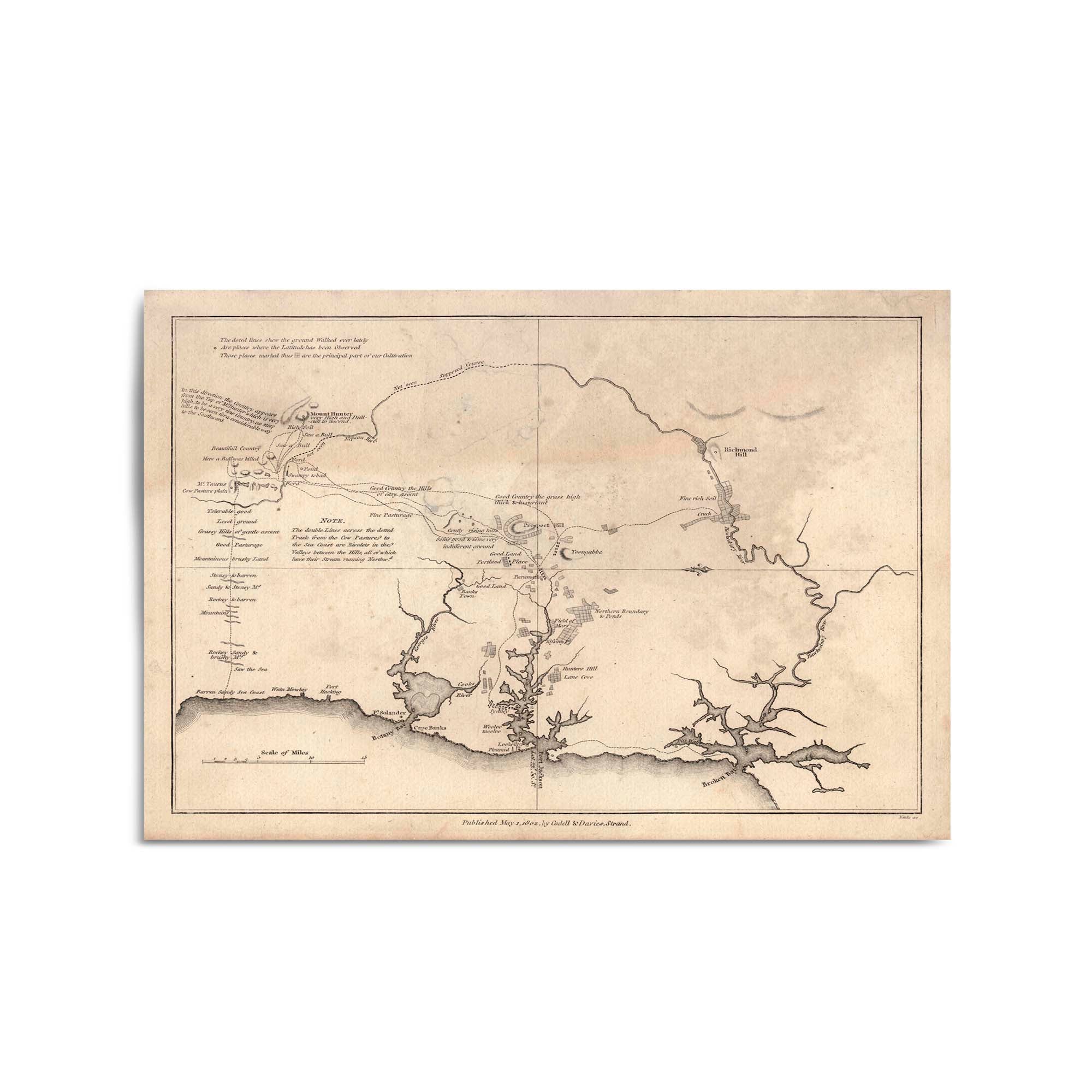
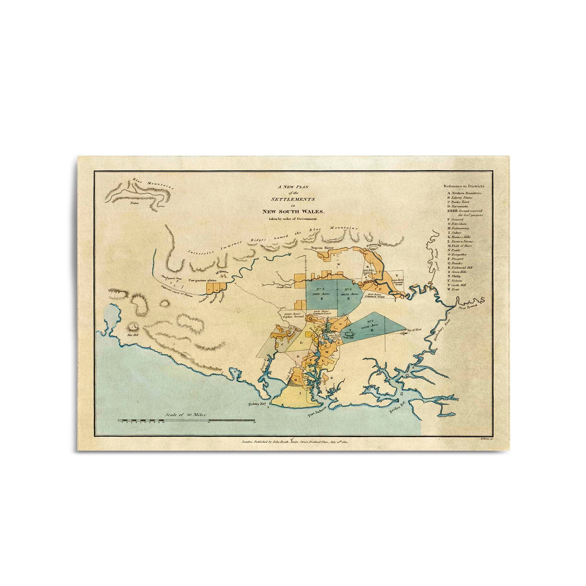
1810 Plan of the Settlements in New South Wales
From
$45.00
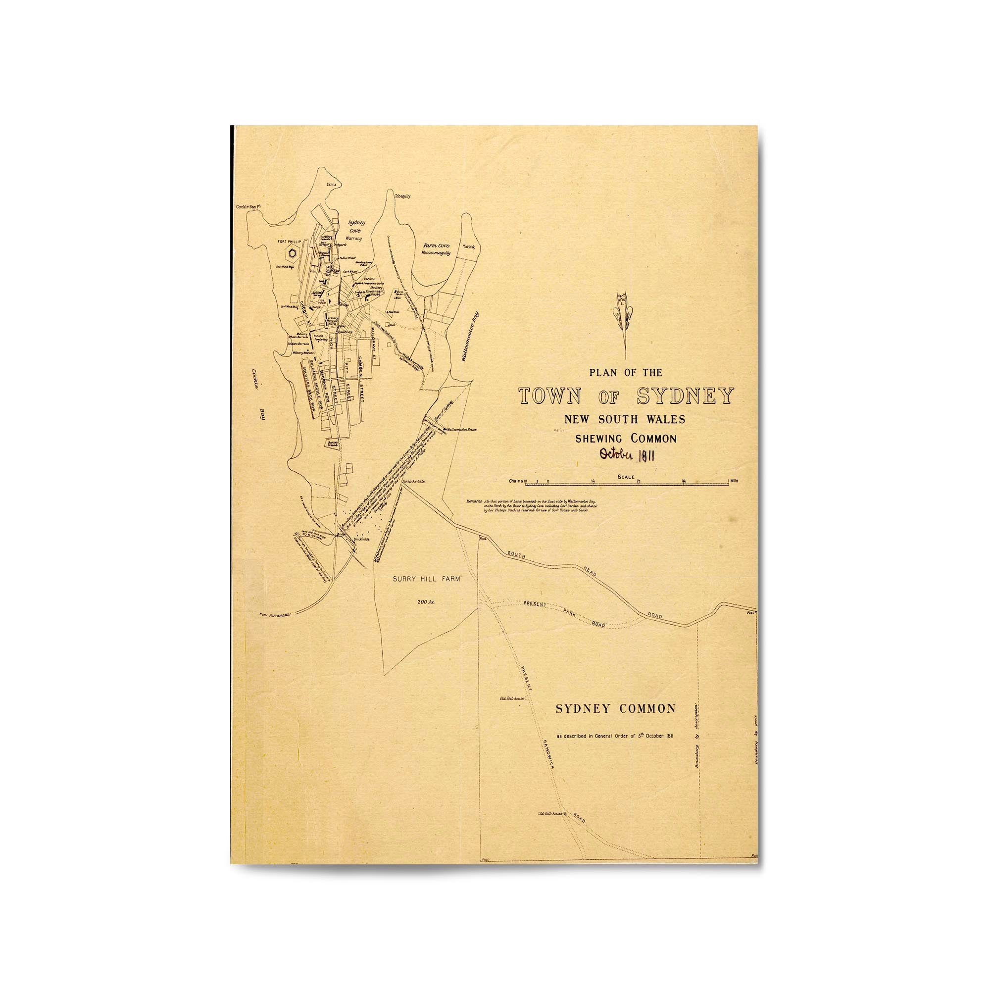
1811 Plan of Sydney, New South Wales
From
$45.00
1812 Map showing layout of Sydney, New South Wales
From
$45.00
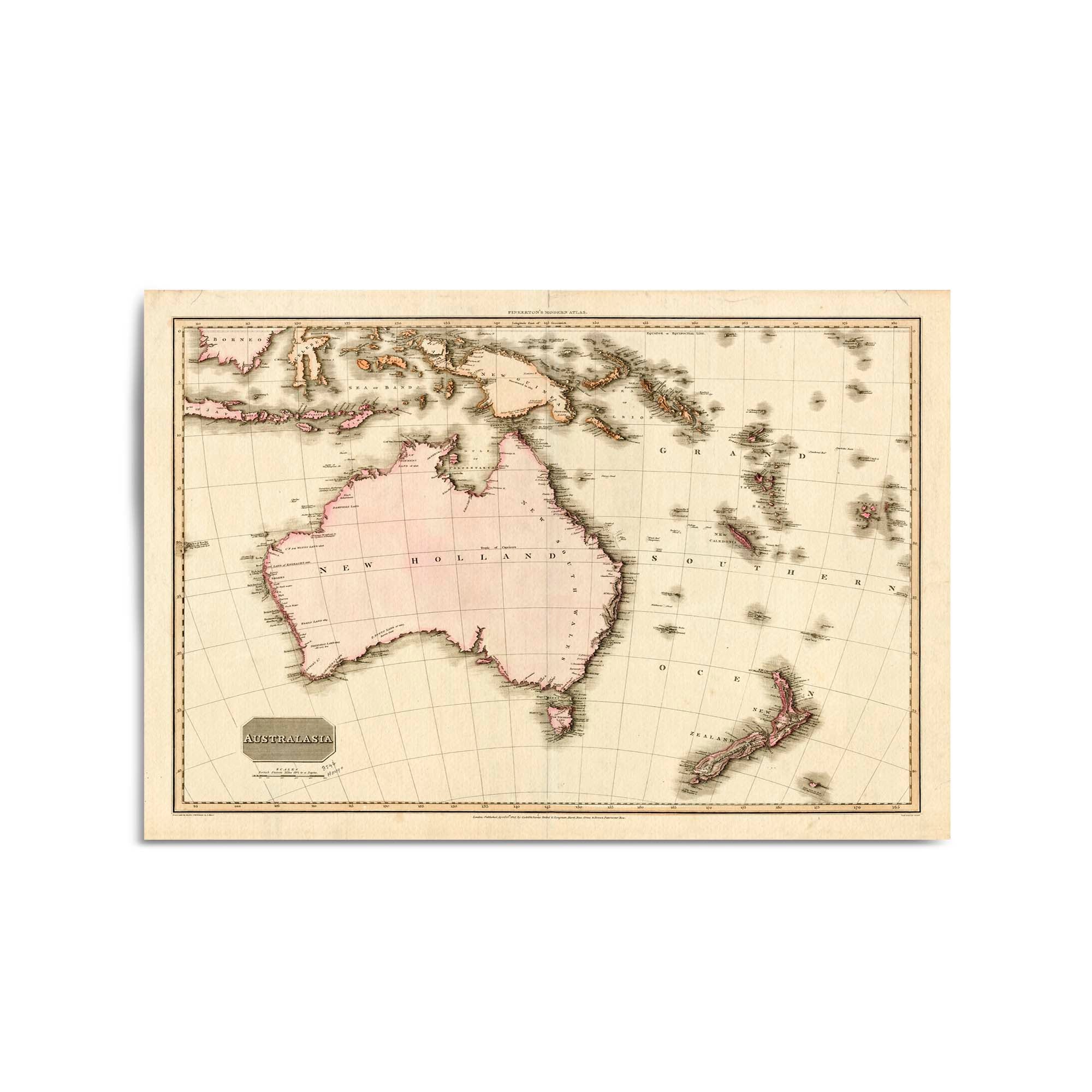
1813 Vintage Map of Australia & New Zealand
From
$45.00
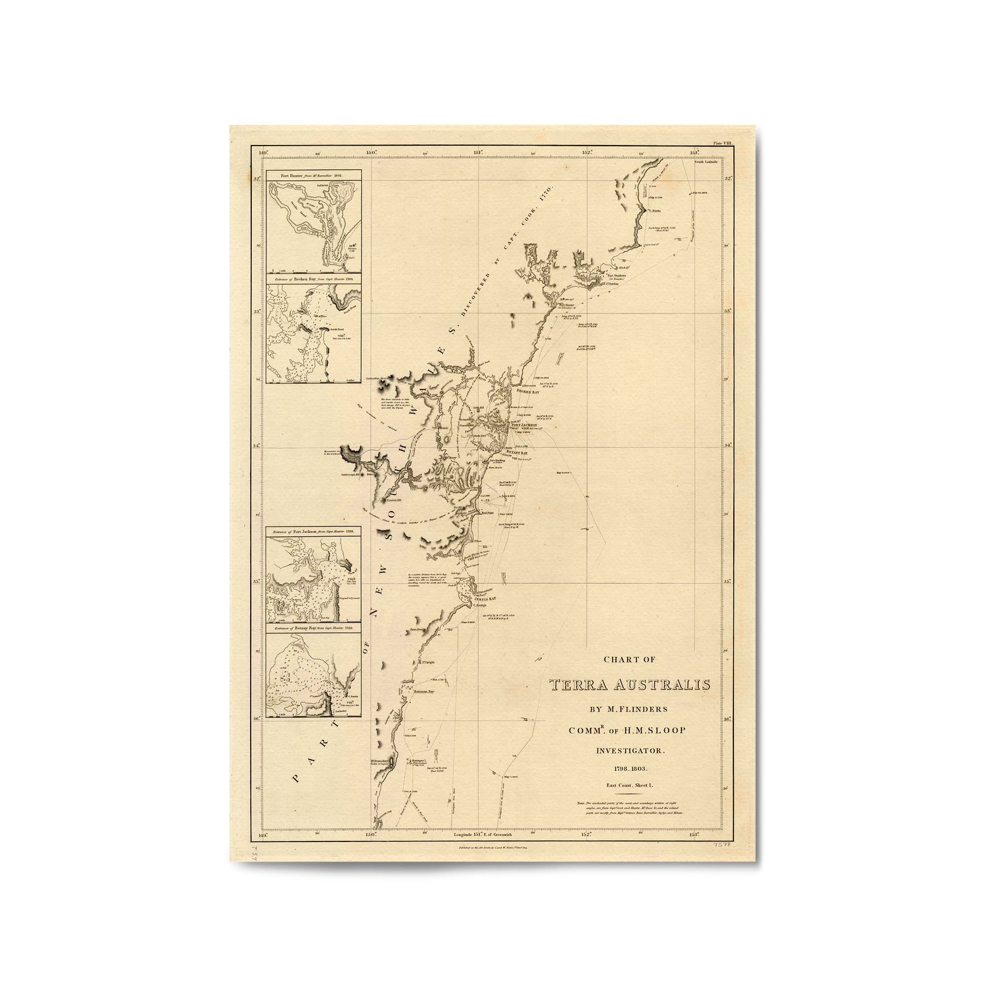
1814 Chart of New South Wales from Barmouth Creek to Cape Hawke
From
$45.00
1814 Chart of New South Wales from Smoky Cape to Moreton Bay in Queensland
From
$45.00
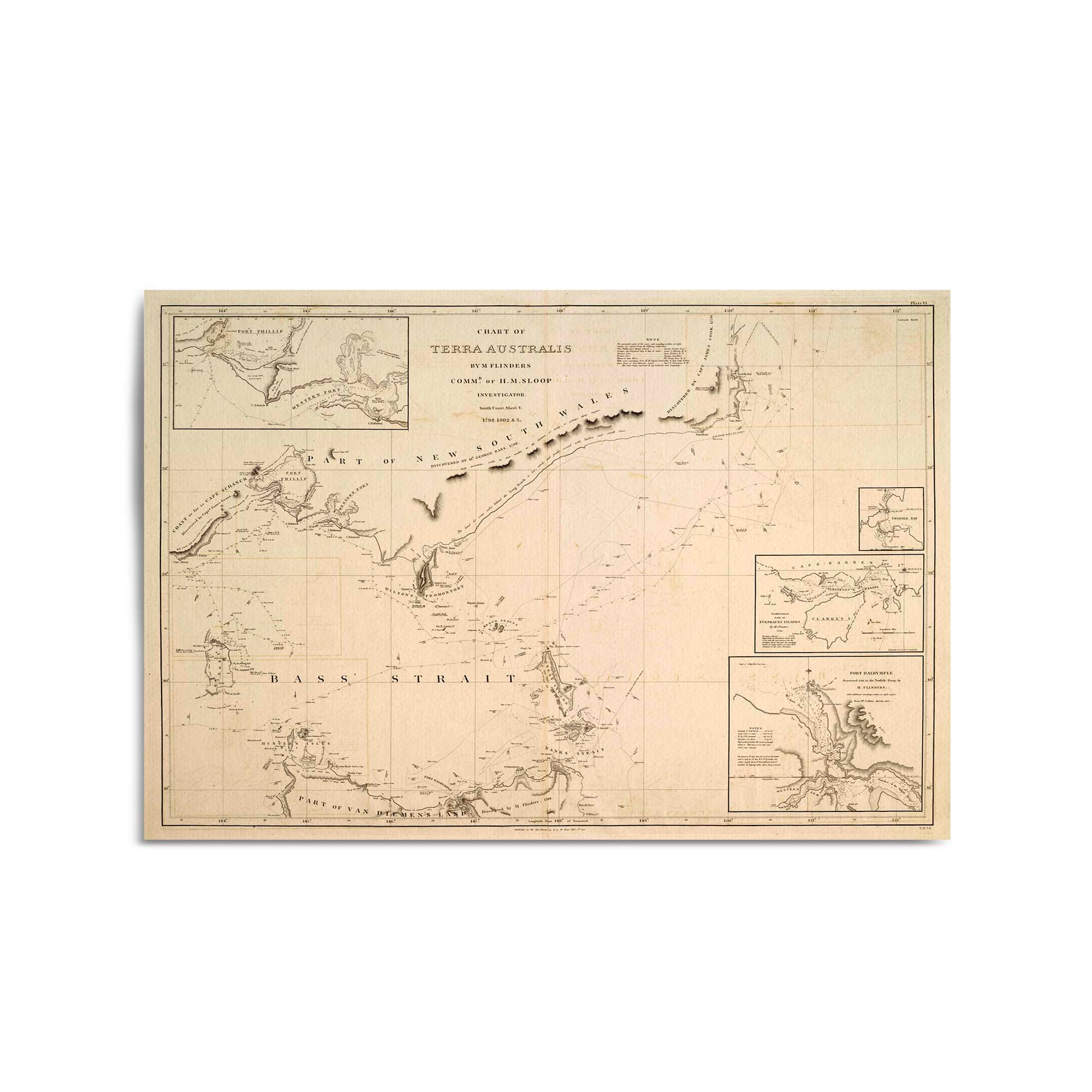
1814 Chart of the Bass Straight, Australia (Terra Australis)
From
$45.00
1814 Drawings of the East and North Coasts of Australia
From
$45.00
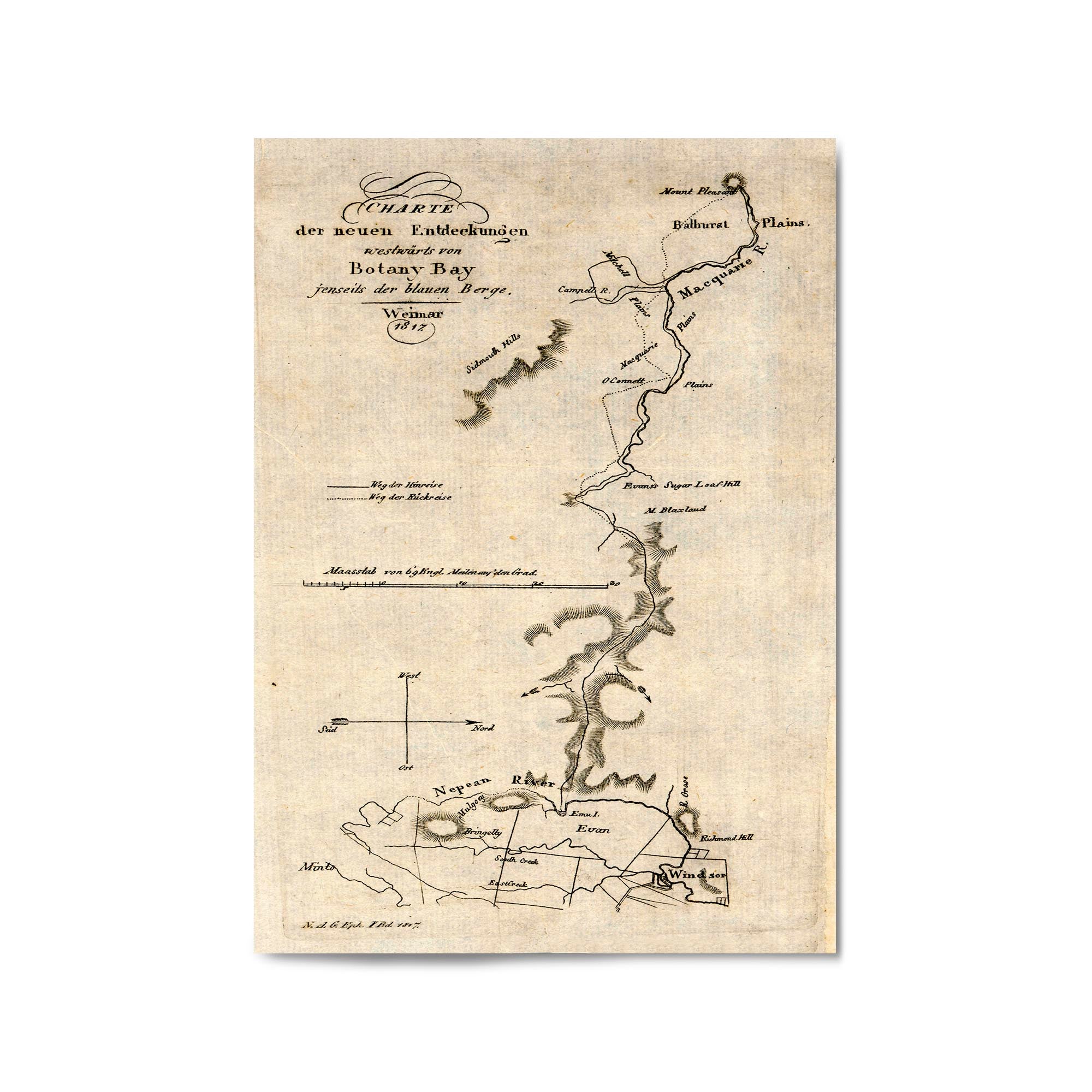
1817 Map of Area North and West of Sydney, New South Wales (German)
From
$45.00
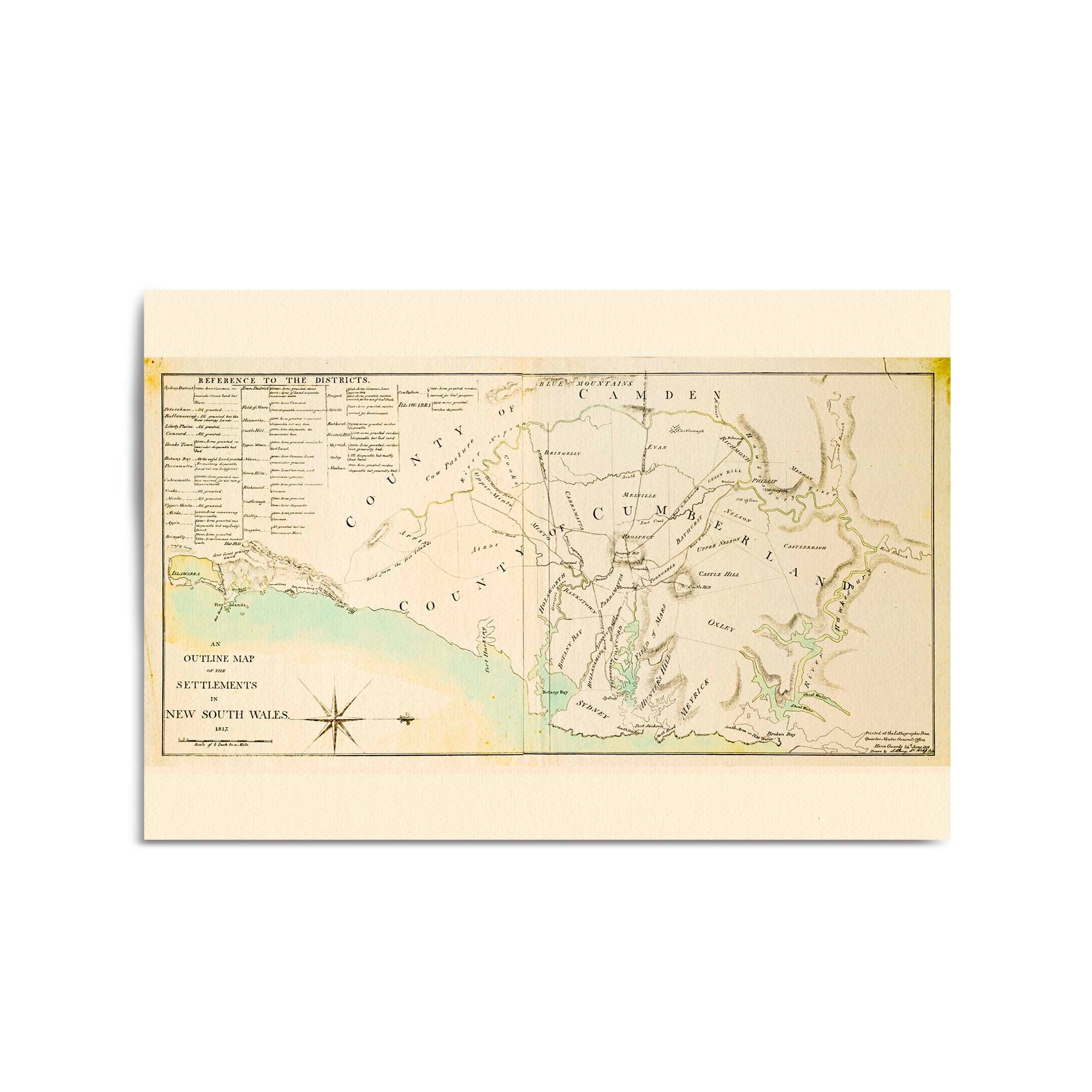
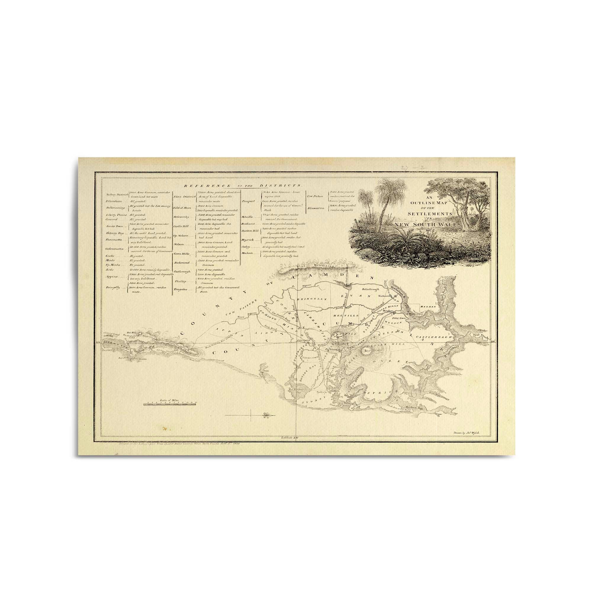
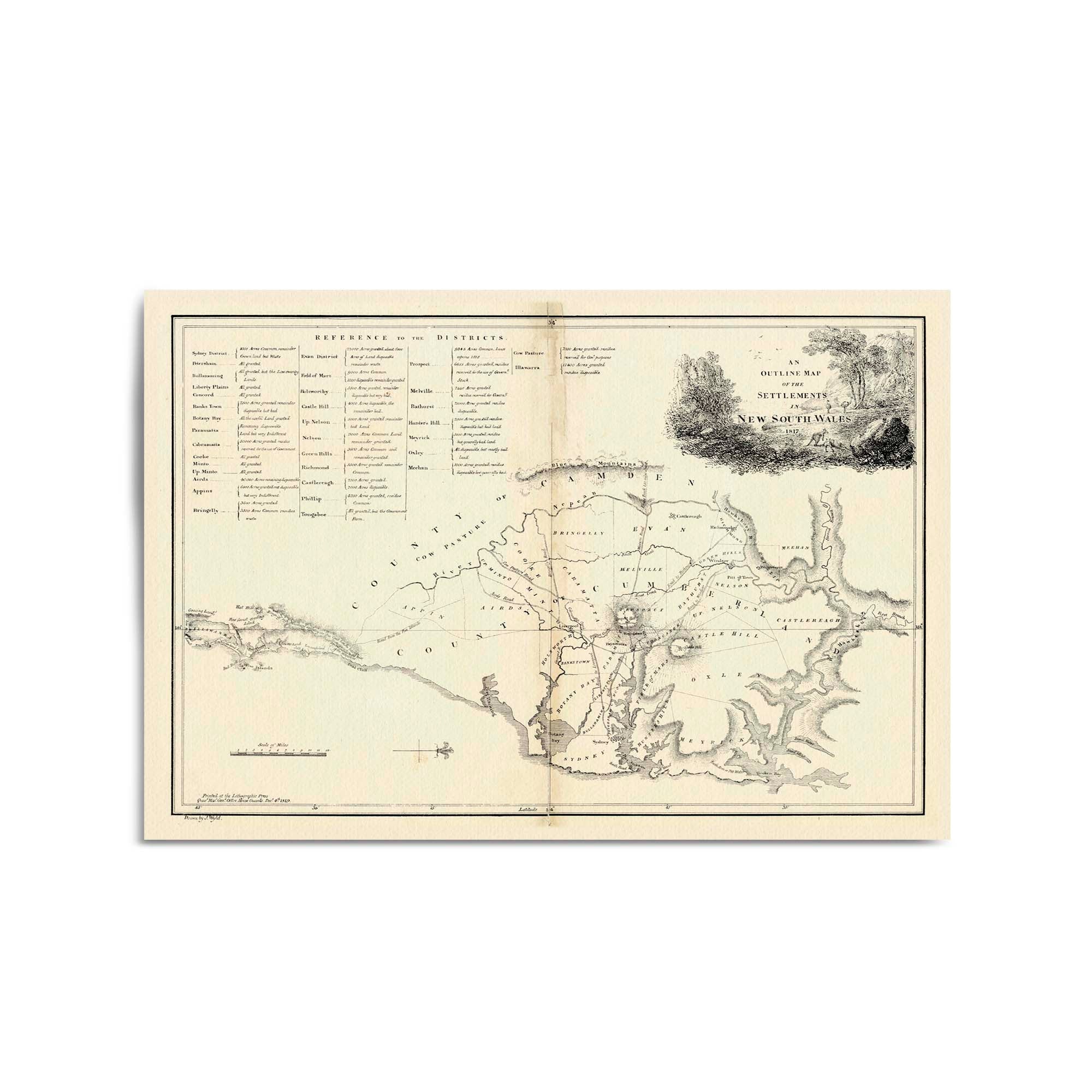
1817 Map of the Settlements in New South Wales
From
$45.00
1817 Map of the Settlements in New South Wales
From
$45.00
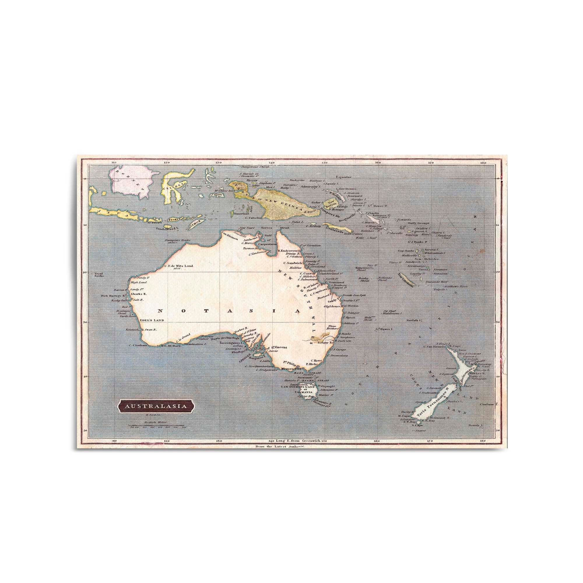
1817 Vintage Map of Australia & New Zealand
From
$45.00
1819 Map of the Settlements in New South Wales
From
$45.00
1820 Map of New South Wales
From
$45.00
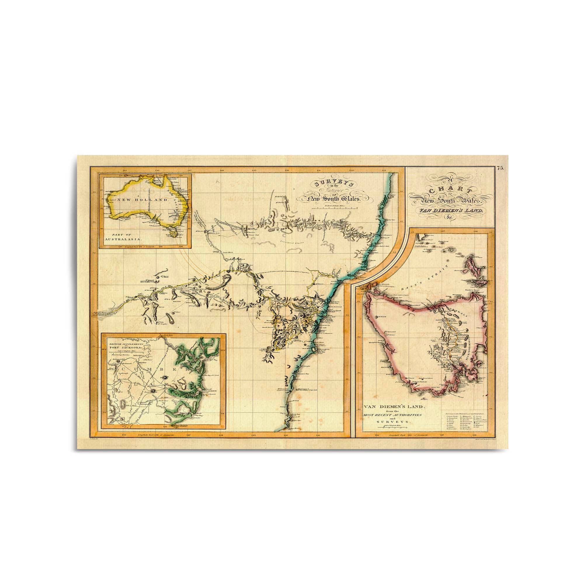
1821 Chart of New South Wales and Van Diemen's Land
From
$45.00
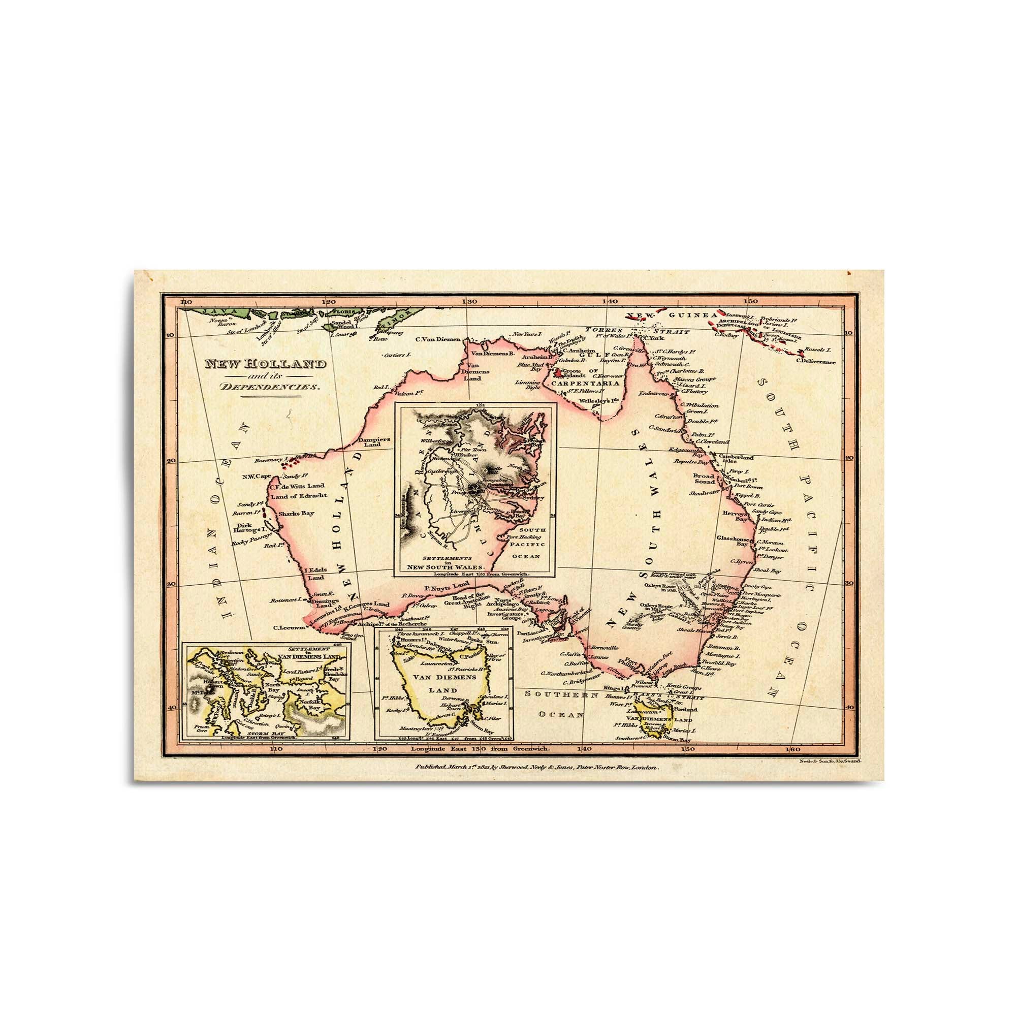
1821 Map of New Holland (Australia) and its dependencies
From
$45.00
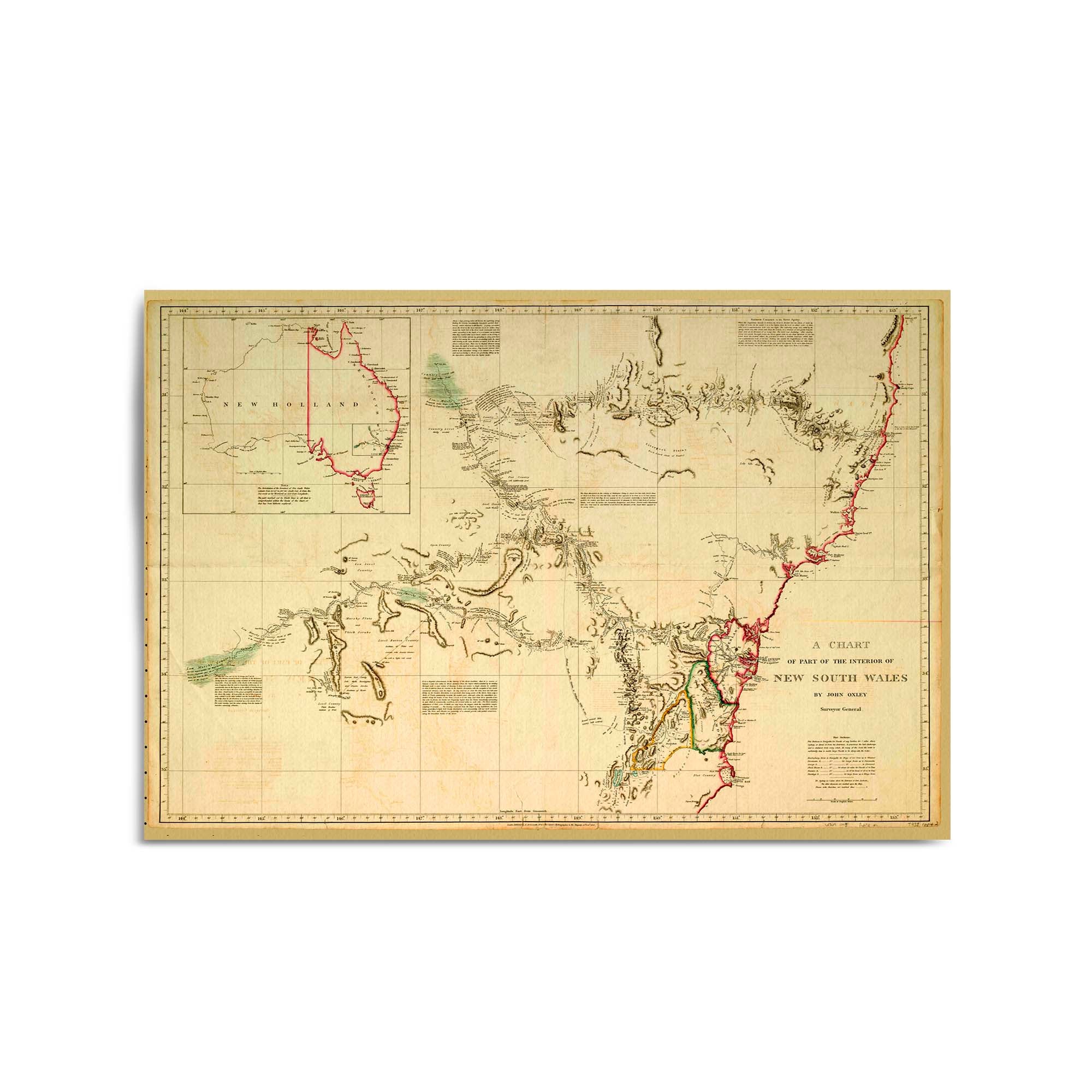
1822 Chart of New South Wales
From
$45.00
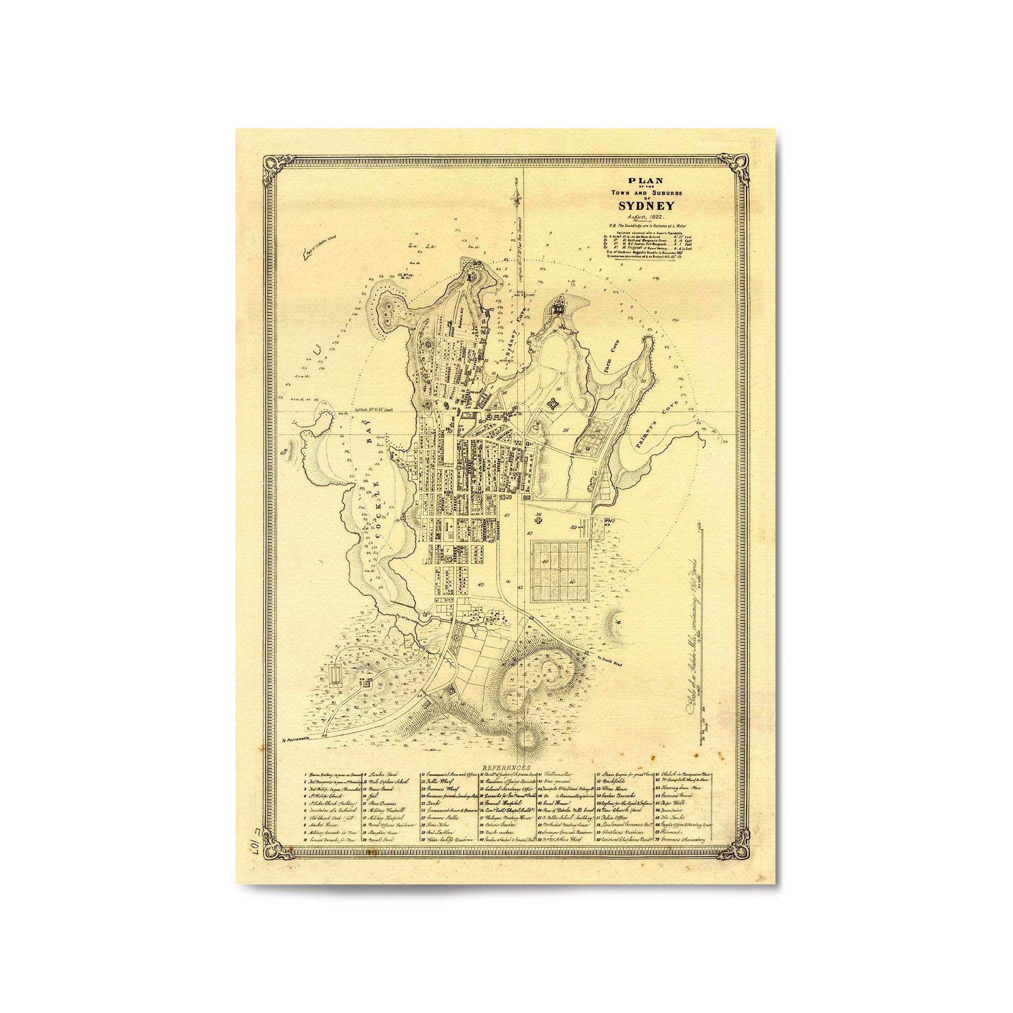
1822 Coloured Plan of the Town and Suburbs of Sydney, New South Wales
From
$45.00
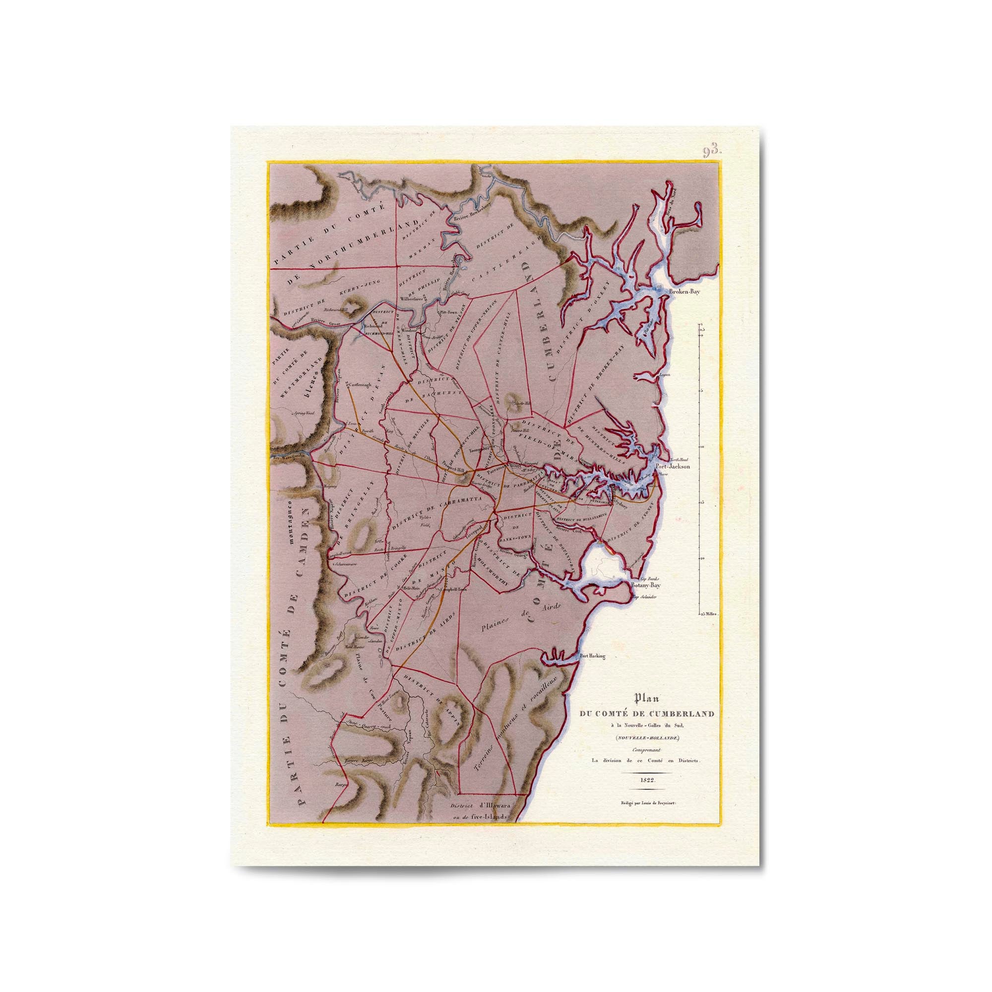
1822 Map of the County of Cumberland, New South Wales
From
$45.00
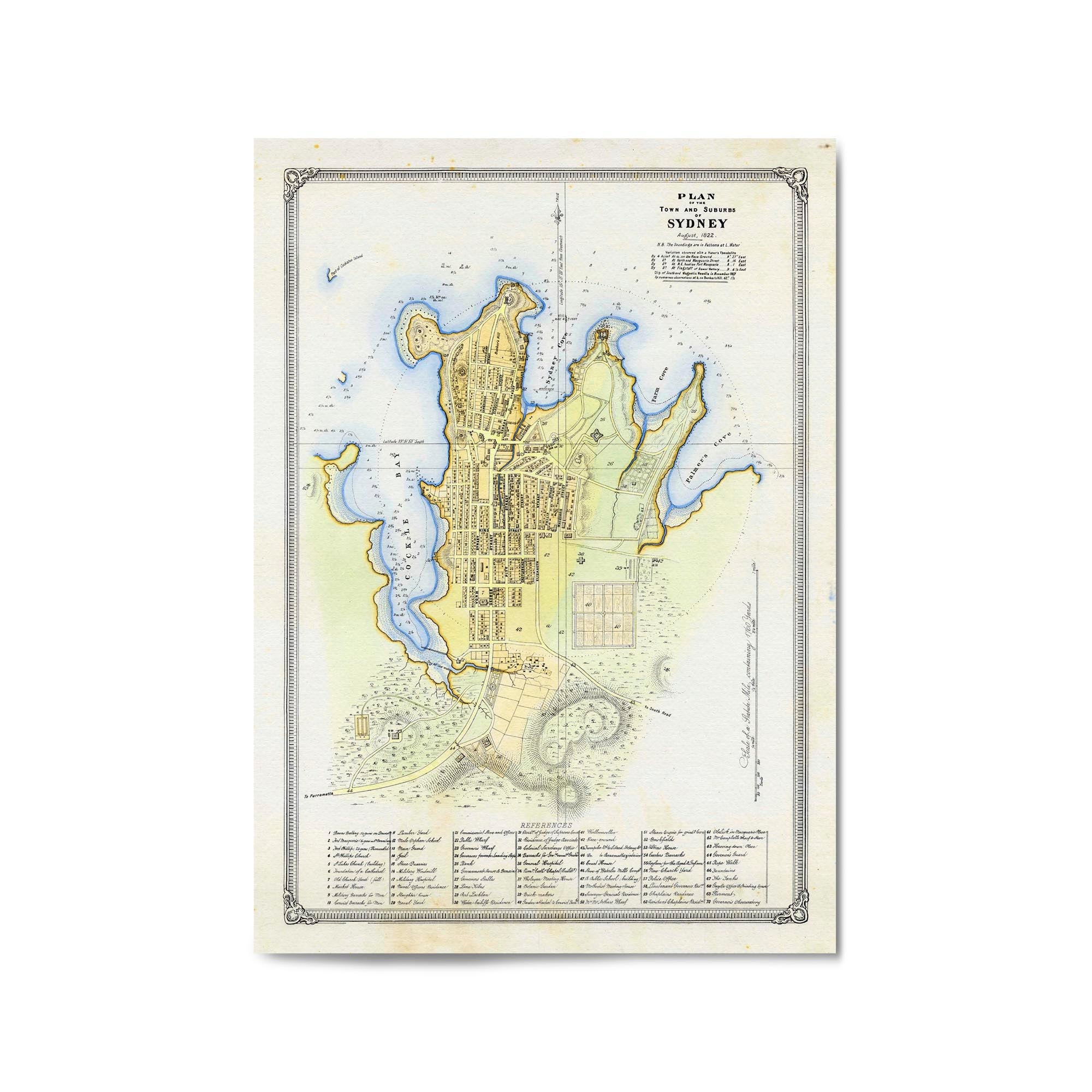
1822 Plan of the Town and Suburbs of Sydney, New South Wales
From
$45.00
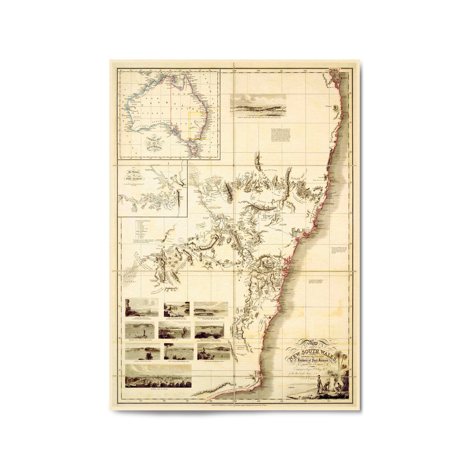
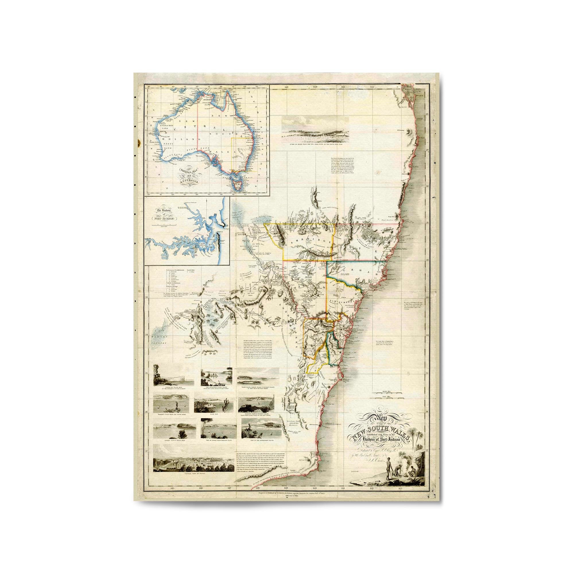
1825 Map of part of New South Wales
From
$45.00
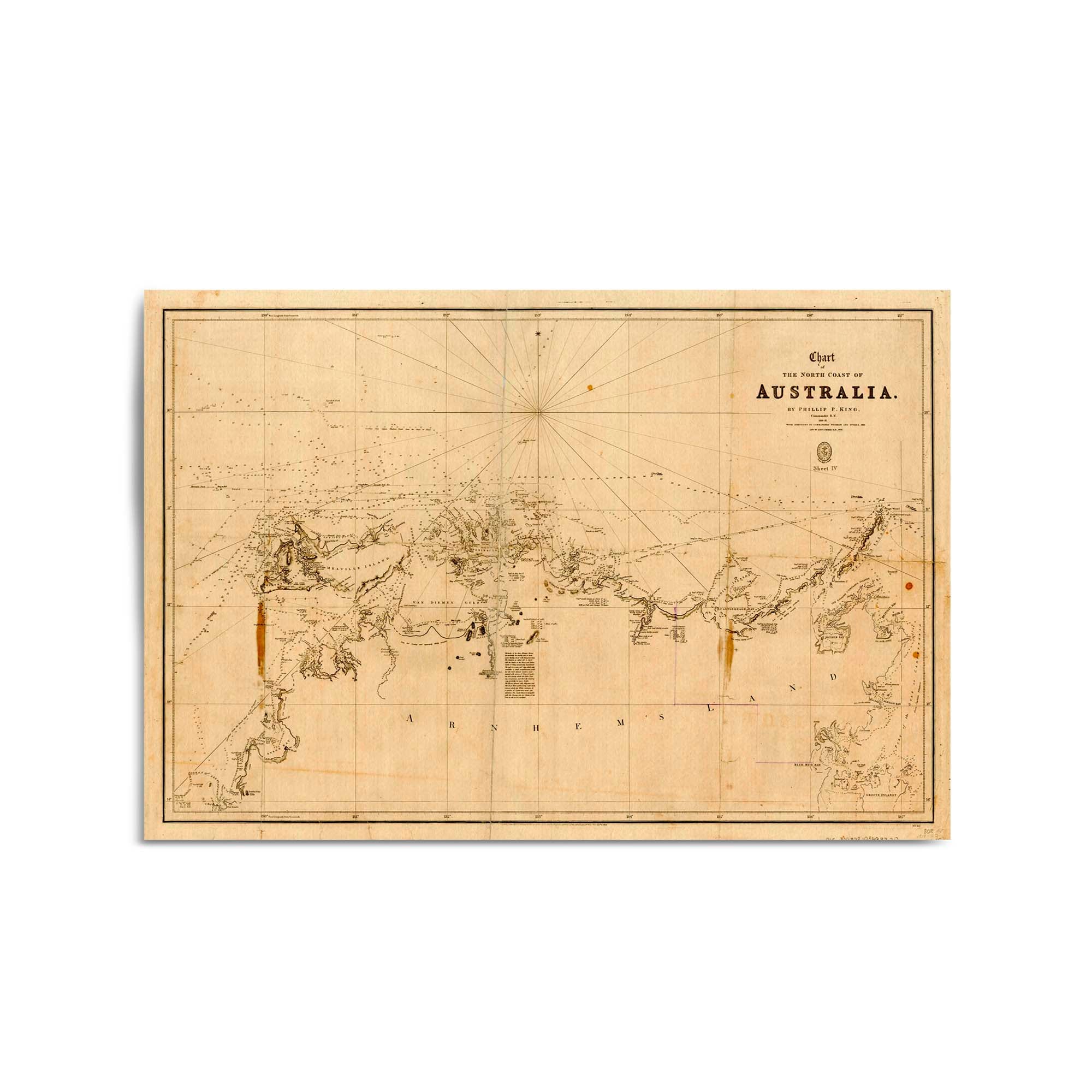
1825 Vintage Map & Chart of Australia - North Coast
From
$45.00
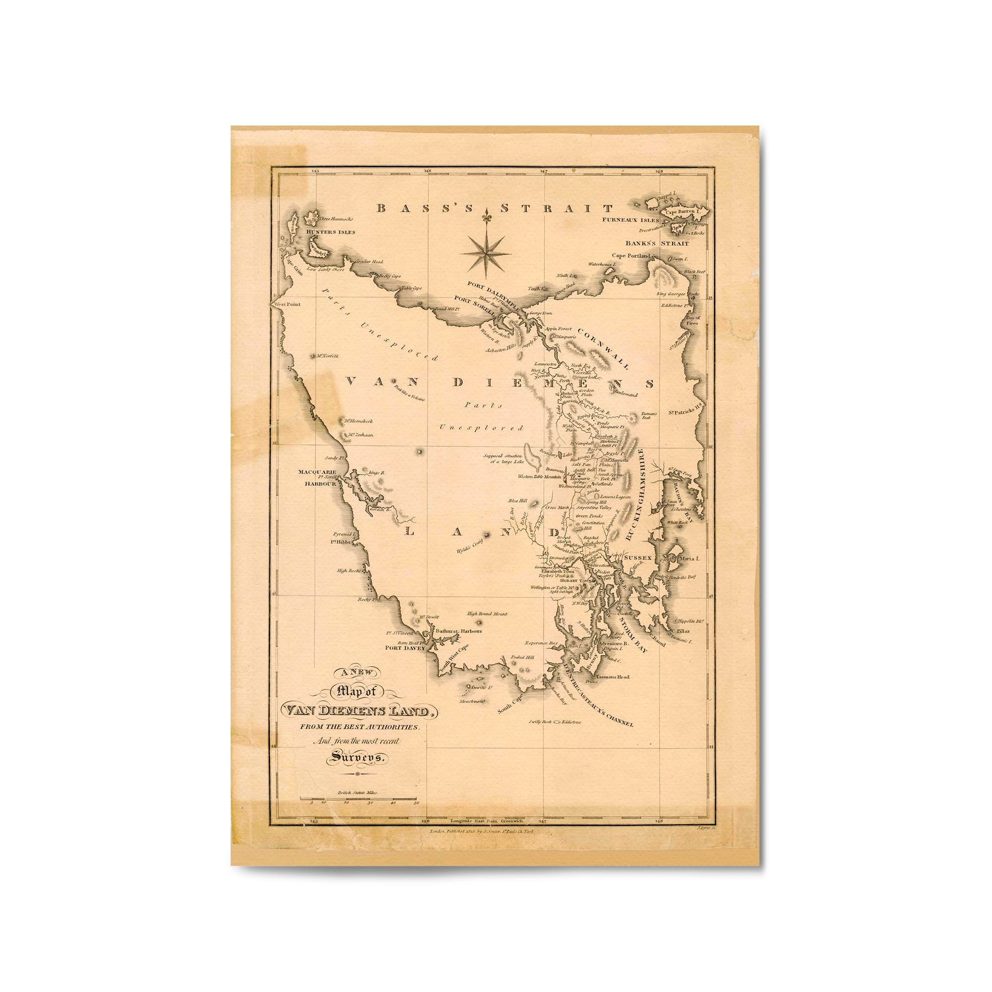
1825 Vintage Map of Tasmania (Van Diemen's Land)
From
$45.00
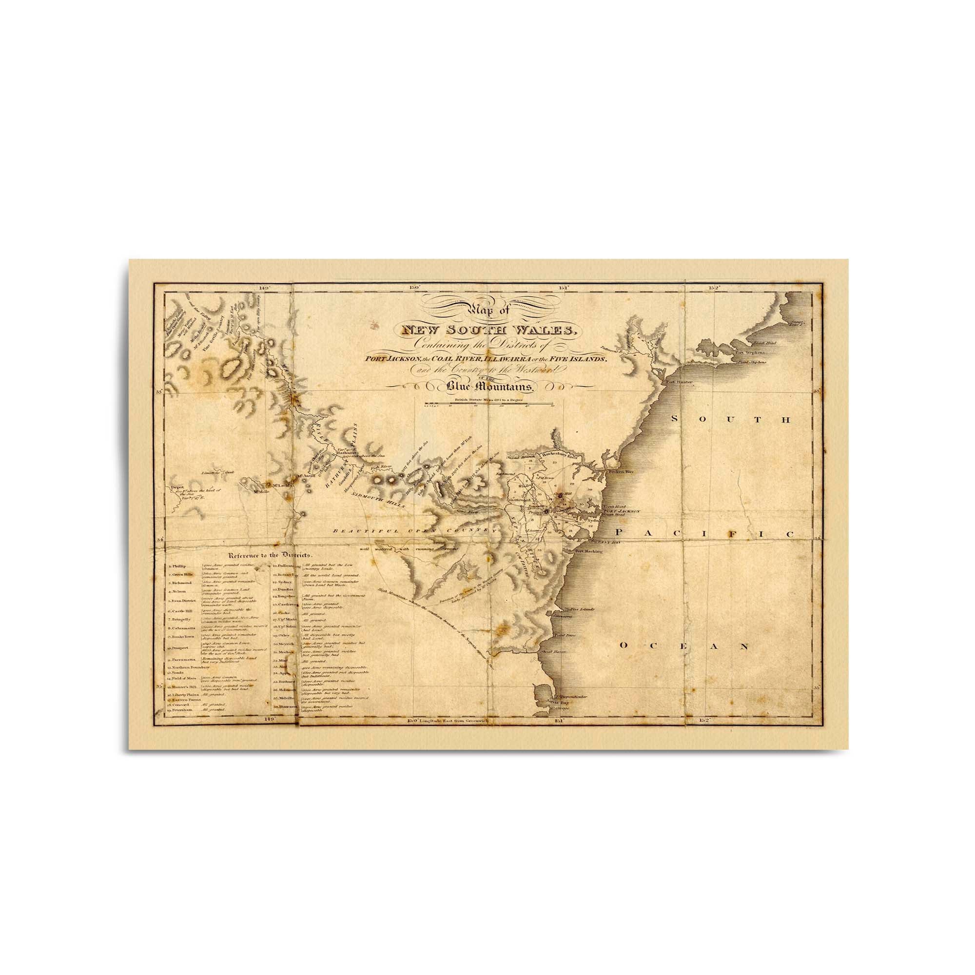
1826 Map of New South Wales
From
$45.00
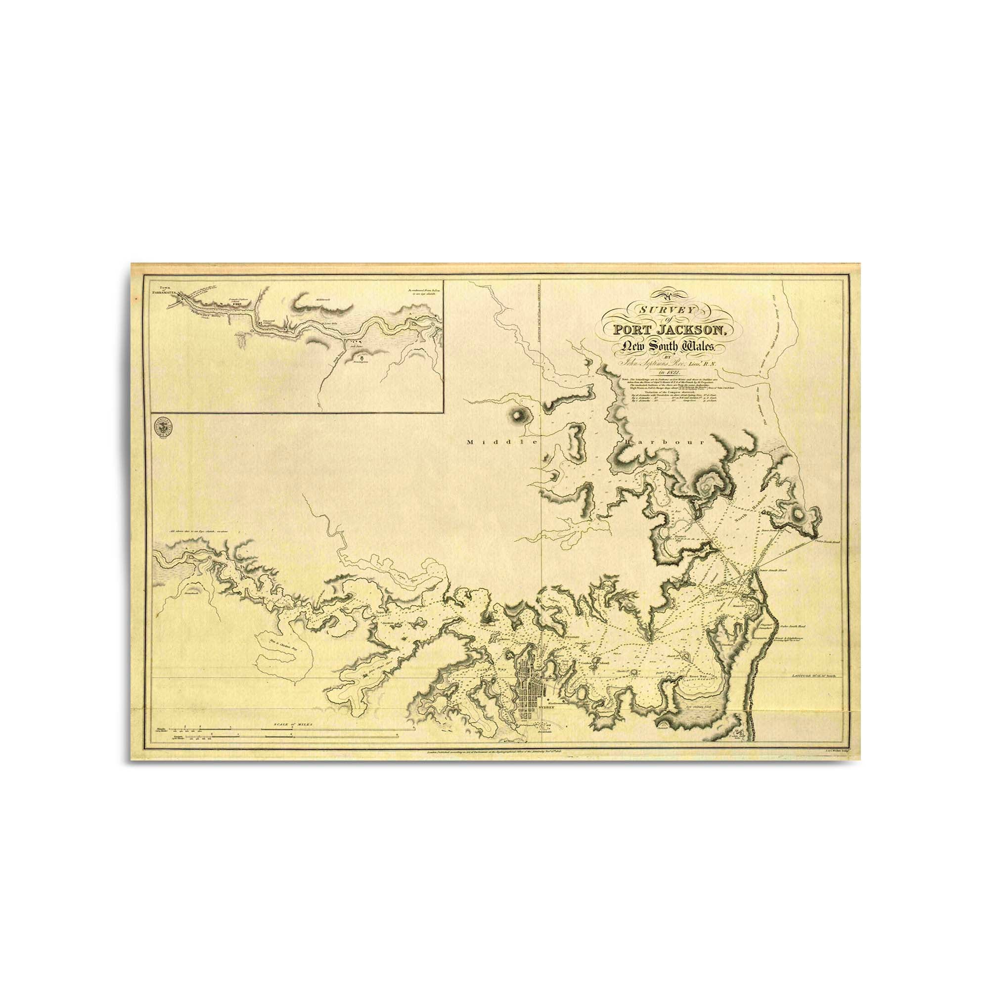
1826 Survey of Port Jackson, New South Wales
From
$45.00
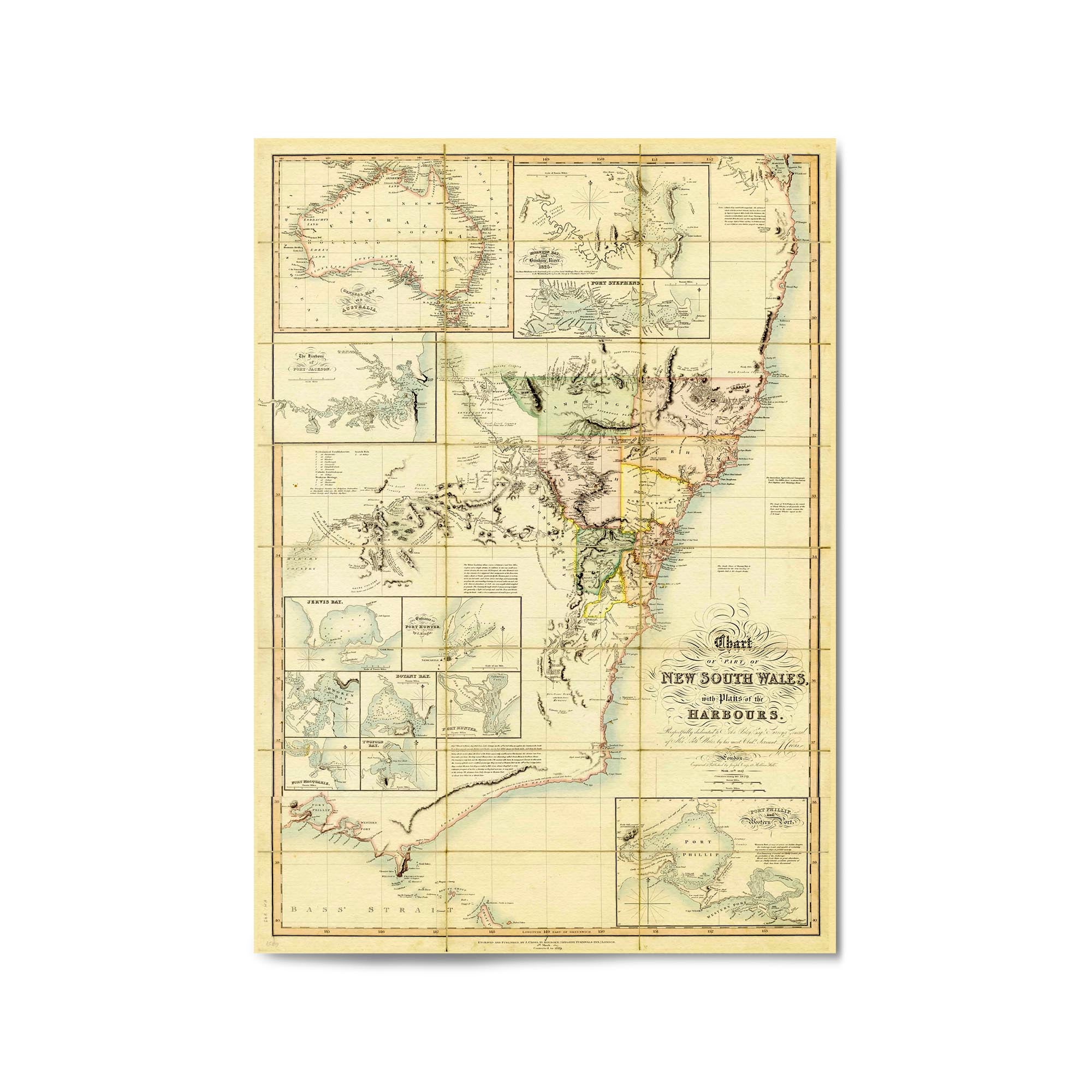
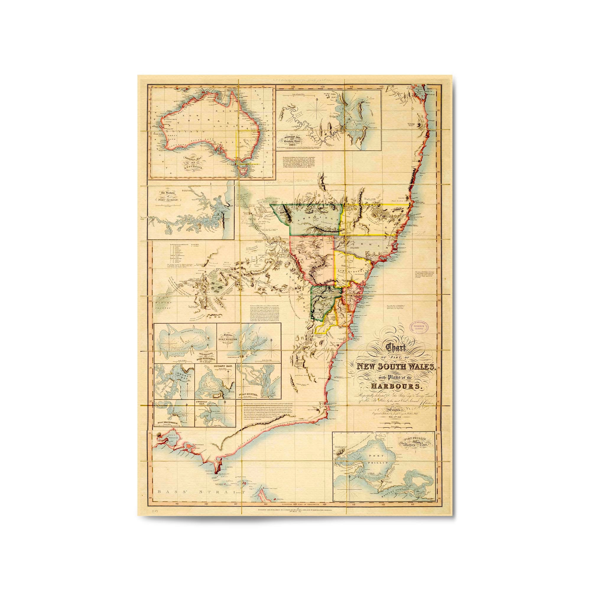
1827 Chart of New South Wales
From
$45.00
1827 Chart of New South Wales
From
$45.00
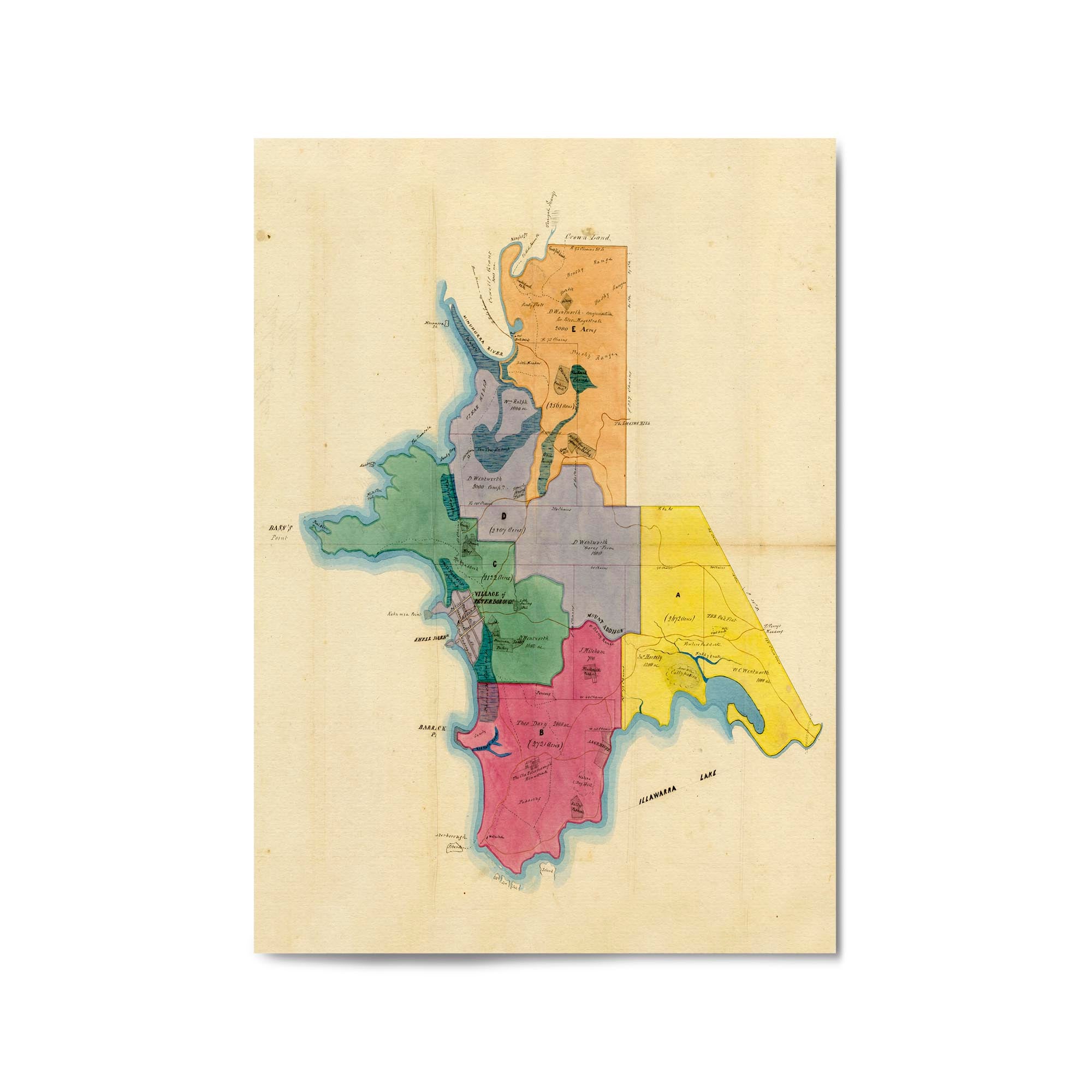
1827 Map of the Peterborough (Wollongong), New South Wales
From
$45.00
« Previous
·
1
2
3
4
…
135
·
Next »